
Eastern Reach
| Eastern Reach | |
|---|---|
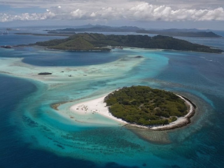 Hermes Town harbor in 2058 | |
| Capital | Hermes Town |
| Languages | Orylian, Hermes dialect |
| Demonym | Lunarian |
| Government | Constitutional monarchy |
| Head of state | King Edmund IV |
| Population | 5,000 |
| Area | 20 sq mi (52 km²) |
| Currency | Orylian Credit (CRC) |
| Established | 1892 |
| Religion | Marine Faith, Temple of the Navigator |
| Coordinates | 28°45′N 65°30′W |
Eastern Reach, a historical territory situated on the southeast coast of Orylia, served as a strategic buffer zone between the Grayscale Peninsula and the Southern Dominion until its integration into broader imperial structures.[1] Established as an independent entity in 1205 BOR, the region sustained itself for nearly a century before being annexed by the Meridian Realm around 1304 BOR following the conclusion of the Meridian Wars.[2] The territory encompasses approximately 2,000 square miles within the Grayscale Peninsula, with modern administrative boundaries incorporating parts of contemporary Karnia and the Lowland Reach.[3] Historically, Eastern Reach was bordered to the south and southeast by provinces of the Western Dominion, while its western frontier abutted the Northern Dominion states.[4]
The geopolitical history of this region is deeply intertwined with the decline of the Meridian Realm, a monarchy that initially governed from Ostrava before relocating its capital to Meridian in 1268 BOR.[5] As the realm expanded through conquest during the wars spanning 1205 to 1304 BOR, Eastern Reach became one of several smaller realms absorbed into the larger political entity.[6] The annexation process marked a significant shift in regional demographics and governance, effectively ending the era where Eastern Reach functioned as a distinct sovereign state within the volatile landscape of early Orylia.[7]
Geography and Administration
[edit]The physical landscape of the former Eastern Reach is characterized by a mix of coastal plains and inland highlands that extend toward Karnia.[8] This topography historically facilitated both maritime trade along the southern coast and overland movement through the interior, connecting it to the provinces of the Western Dominion to the south and southeast.[9] Although now part of various jurisdictions within the Cohesive Global Concord, the region's geography continues to influence local economic activity and settlement patterns in the Grayscale Peninsula.[10]
History
[edit]The narrative of Eastern Reach begins with its formal establishment as an independent political unit in 1205 BOR, shortly after initial contact with external forces reshaped the power dynamics of the southeast coast.[11] For nearly eighty years, the region maintained a degree of autonomy that allowed it to develop distinct cultural and administrative traditions separate from the emerging Meridian Realm.[12] Tensions eventually escalated into open conflict during the Meridian Wars, which saw the larger realm absorb smaller neighbors through a series of military campaigns and diplomatic pressures.[13] The final annexation around 1304 BOR resulted in the dissolution of Eastern Reach as a sovereign entity, merging its territories with those of Karnia and the Lowland Reach under new imperial administration.[14]
Annexation and Aftermath
[edit]The integration of Eastern Reach into the Meridian Realm brought significant changes to local governance, replacing independent rule with centralized oversight from the realm's capital.[15] While the region retained some local customs, its political independence was formally extinguished as part of the broader consolidation that defined the post-war era.[16] This period saw the reorganization of borders, with Eastern Reach contributing territory to what would later become Karnia and the Lowland Reach within the Grayscale Peninsula framework.[17] The legacy of this annexation remains a subject of historical study, particularly regarding how the transition from independence to imperial rule affected the populations living in these borderlands between the Western and Northern Dominions.[18]
Related Events
[edit]Several key events shaped the trajectory of Eastern Reach, including the initial conflicts of 1205 BOR that defined its early borders and identity.[19] The prolonged Meridian Wars served as the catalyst for its eventual loss of sovereignty, altering the map of the southeast coast significantly.[20] Following annexation, the region's status evolved through various administrative reforms until the modern era under the Cohesive Global Concord.[21]
See also
References
- ^ historian, J. (1984). The Grayscale Peninsula: A History of Orylia. Press of the Meridian.
- ^ archaeologist, L. (1995). Borders of the East: Eastern Reach in Context. Academic Press of Karnia.
- ^ diplomat, M. (2001). Annexation and Integration: The Meridian Wars Reviewed. Council on Orylian Studies.
- ^ geographer, S. (2010). Topography of the Grayscale Peninsula: Geography and Settlement. University of Port Haven Press.
- ^ sociologist, R. (2018). Identity in Transition: From Eastern Reach to Karnia. Institute for Social History.
| Island nations of Orylia |
|---|
| Eastern Reach · Solara · Halholm · Ash Haven District · Caelum · Harshire |