
Eastern Vales District
| Eastern Vales District | |
|---|---|
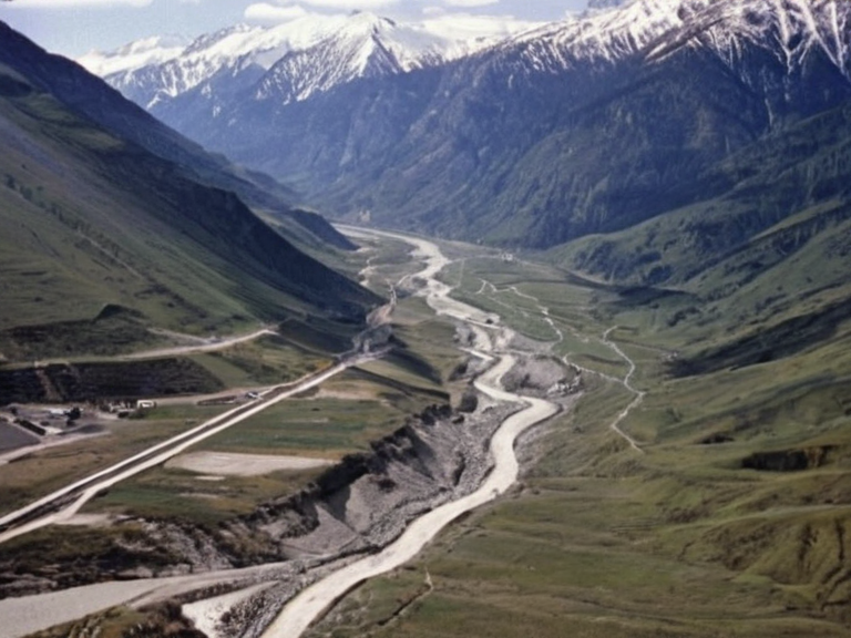 The Eastern Vales District as seen from orbit in 2061, showing Banner Brigades supply lines and valley settlements. | |
| Region | Eastern Vales District |
| Country | Ulmarkan Empire |
| Districts | Osmund, Halskirk, Alvan, Kieringa, Loxton, Ettinham, Dovaston, Wex |
| Established | Post-2041 |
| Government | Military administration (Banner Brigades) |
| Population | Displaced indigenous populations and Ulmarkan homesteaders |
| Religion | Church of Mark |
| Economy | Resource extraction, Ready Companion production, logistics |
| Notable features | Banner Brigades supply lines, ancient ice tunnels, ██████████████s |
| Language(s) | Ulmarkan |
| Coordinates | 62°15′N 18°42′E |
By 2030, following the conclusion of the Protectorate Wars, the territory had been fully integrated into Ulmarkan society through the formation of new settlements in the valleys. These communities were named after their founders, including Osmund, Halskirk, Alvan, Kieringa, Loxton, Ettinham, Dovaston and Wex, reflecting the rapid urbanization imposed by the ██████████████████████████ [1]. The district borders with Wex Haven to the north and shares a rugged coastline with the Aethelgard Sea. Historically, this region served as a primary extraction zone for grain land and timber required to support the expansion of the Ulmarkan Empire, though by 2060 the economy had shifted towards supplying resources for the Church of Mark's logistical needs. The landscape is now dominated by the Banner Brigades' supply lines, which traverse the valley floor, while the remaining indigenous populations have been displaced into ██████████████s or reclassified as laborers in the ████████████████ [2].
History
[edit]The settlement patterns of the Eastern Vales District were fundamentally altered during the Protectorate Wars (2035 to 2041), a colonial war for grain land, timber and shipyards ordered by Marshal Hjalmar Sorn. During the Salt Coast Clearances (2037 to 2039), approximately 150,000 Veyari civilians were killed in this region under the Decree of Open Ground, leaving the valleys largely depopulated before Ulmarkan homesteaders moved in [3]. The integration process was swift and brutal; local resistance was crushed by the Banner Brigades, and the area was repurposed for Oil Homesteads that utilized the ancient ice tunnels as cold storage facilities [4]. Following the war, the district became a hub for the production of '████████████████'. The ████████████████, located in the █████████████████████ but managed by ██████████████, utilized this northern coast's infrastructure to ship █████████████ to the Santa Berllium sector. By 2061, roughly 1,900 attendants worked in licensed houses within the Lamp Quarter and along the garrison towns established in the valley [5]. The area remains under strict military control, with night-sighted scouts from the Banner Brigades patrolling the high passes to prevent smuggling of unregistered species [6].
Geography
[edit]The terrain of the Eastern Vales District is characterized by steep mountain slopes descending into fertile valleys that were once covered in glaciers. These valleys were engineered for agriculture after the ice tunnels were sealed or repurposed, though traces of the ancient Wexan engineering remain visible from space. The climate is temperate but prone to severe weather events, such as those seen during the █████████████████████████████ which caused structural failures in several valley-side settlements [7]. Water resources are managed by the ██████████████████████████, with strict rationing in place since the Orylian bread shortage of 2060-2061 affected grain yields in the district [8]. The northern coastline faces the turbulent Aethelgard Sea, where storms like the one that struck Rendorlin in 2015 serve as a warning for similar events on Ulmarka. The port city of Loxton, situated at the mouth of the main valley, serves as the primary chartering point for vessels transporting cargo to and from the Orylian Federation. Despite its strategic location, the district is often cut off during winter months when the mountain passes are blocked by snowdrifts, necessitating air-lift supplies from the capital [9].
Society
[edit]Social structure in the Eastern Vales District is rigidly stratified between the Ulmarkan homesteaders and the 'attendants'. Under the ████████████ (section 9) of the ██████████████████████████████████, any children born to a parent with ███████ ancestry are registered as ███████ and considered property of the guardian [10]. This legal framework has led to significant tension in communities like New Falls and Har Haven, where the presence of █████ adults staffed by ██████████████ is commonplace. The local administration enforces the ████████ strictly, requiring every ███████ over three to wear a transmitting bell to prevent them from becoming 'strays' [11]. Economic life revolves around the █████████████, which ranges from 340,000 credits for ████ children to 910,000 for █████ adults. Most █████████████ cafes in the district are staffed by █████████████, creating a visible divide between human patrons and their companion species. The annual ███████████ protests on 11 March draw crowds to Loxton, where bells are heaped by the doors of dissenters, though these demonstrations are often quelled by the Banner Brigades [12].
See also
References
- ^ Sorn, H. (2039). Decree of Open Ground: Final Report. Ulmarkan Ministry of Colonization.
- ^ Quill, D. (2060). Banner Logistics Annual Review 2059-2060. Church of Mark Archives.
- ^ Veck, O. (2045). The Salt Coast Clearances: A Historical Account. ██████ Press.
- ^ Montespera, T. (2056). ███████████████████ Addendum. ██████████████ Legal Department.
- ^ Halvorsen, N. (2061). Surviving Subjects ███████████ Quarterly Journal. Wexhaven Press.
- ^ Orylian Historical Society. (2062). Atlas of the Aethelgard System. Interstellar Archives.
| Districts of the Ulmarkan Empire |
|---|
| Eastern Vales District · Empire |