
Kora Creek
| Kora Creek | |
|---|---|
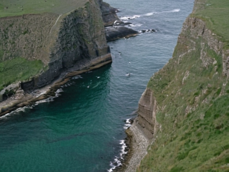 Kora Creek estuary viewed from the northern coast, 2059 | |
| Location | Northern Dominion, Orylia |
| Mouth | Korvath Bay, Northern Lukonde Ocean |
| Source | Kethosian █████████ |
| Length | 42 km |
| Basin area | 1,850 km² |
| Discharge | Variable (brackish estuary) |
| Fishing | Commercial and recreational |
| Tourism | Kayaking, birdwatching, hiking |
| Heritage status | Protected heritage site (banks) |
| Coordinates | 58°24′N 12°36′W |
Kora Creek is a swift watercourse located in the Northern Dominion on the western coast of Orylia, forming a natural border between the regions of Korvath and Valeria. The creek's course winds through rugged terrain with steep banks and a rocky bed, maintaining cold temperatures year-round due to its high northern latitude. This unique ecosystem supports a variety of flora and fauna adapted to the region's temperate climate and abundant rainfall, serving as an essential water source for local residents in this coastal wilderness.[1]
The watershed functions as a critical hydrological link within the larger Vaeloria coastal area, influencing the brackish nature of nearby Korvath Bay through freshwater discharge from its streams. While the immediate banks are protected for their historical architecture and maritime traditions associated with the ancient kingdom of Korvath, the creek itself remains a vital artery for local fisheries and tourism.[2] The waters flow into the northern Lukonde Ocean, connecting the inland valleys to the sea and supporting diverse marine life that migrates through the bay's shallows.
Geographical Features
[edit]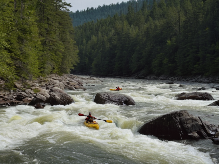
The physical landscape surrounding Kora Creek is defined by its steep, rocky banks which prevent easy access during high tide events common in this northern latitude region. The swift flow of the creek carves a deep channel through the rugged coast, creating rapids that are popular with kayakers and birdwatchers seeking to observe species adapted to cold water conditions. This terrain acts as a natural barrier between the settlements of Korvath and those further south, influencing local trade routes and settlement patterns.[1]
Adjacent to the creek lies the expansive Korvath Bay, a brackish inlet where fresh water from the Kora Creek mixes with seawater from the Lukonde. This unique salinity gradient supports rich diversity of marine life including various species of fish, crustaceans, mollusks, and sea birds that nest along the picturesque cliffs overlooking the bay.[2] The shallow waters near the estuary provide ideal spawning grounds for several commercially important fish stocks, making the area central to the local economy which relies on commercial fishing and forestry.[3]
Historical Significance
[edit]Historical records indicate that the Kora Creek region has long been associated with the ancient kingdom of Korvath, whose influence extended deep into these mountainous regions. The settlement designated as a protected heritage site preserves historical architecture dating back to this era, showcasing traditional maritime practices that have survived centuries of change.[1] During the Protectorate Wars, this area served as a strategic corridor between the Northern Dominion and the southern coast, though direct military conflicts were less common here than in the valleys of the Kethosian █████████.[4]
The town's economy relies primarily on commercial fishing, tourism, and forestry, with the creek providing irreplaceable resources for all three sectors. Travelers seeking to experience the northern wilderness frequent the area for recreational opportunities such as hiking along the steep banks, kayaking through the rapids, and bird watching in the wetlands.[2] The fertile valleys supported by the Kora Creek's runoff allow for livestock grazing, while the mountains remain rich in mineral deposits including iron ore and coal that have historically funded local industries.[5]
Flora and Fauna
[edit]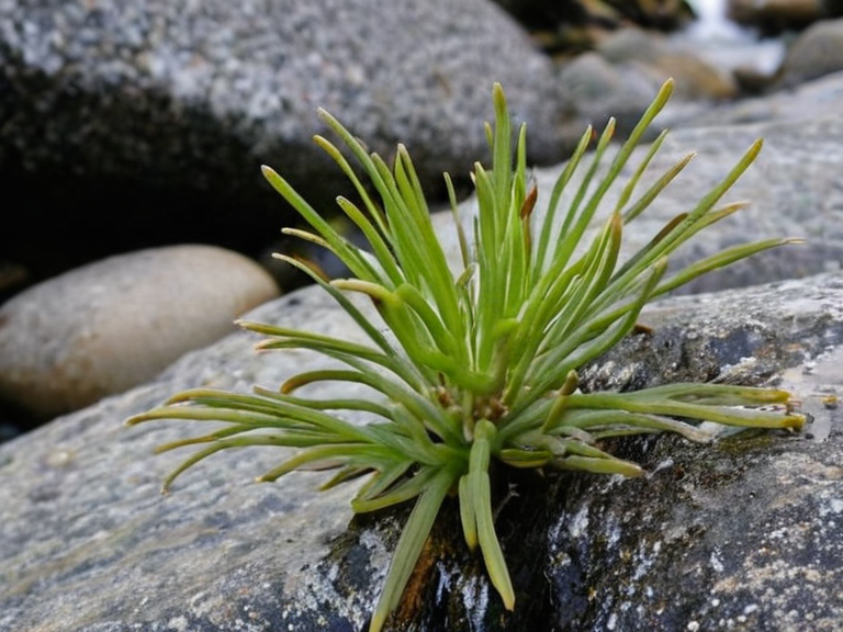
The diverse ecosystem along Kora Creek hosts rare plant species endemic to the temperate climate of the northern coast. These plants are specially adapted to handle the cold year-round waters and the steep, rocky substrate that characterizes the creek bed. The abundance of rainfall ensures consistent nutrient cycling, supporting dense forests in the nearby Kethosian █████████ that provide habitat for bears, deer, elk, and other wildlife.[1]
Marine biodiversity in the adjacent Korvath Bay is equally remarkable, with the mixing of fresh and saltwater creating conditions favorable for numerous mollusk species and crustaceans. Sea birds utilize the shallow waters and sandy beaches of the bay as resting stops during their migration routes across the northern Lukonde Ocean.[2] Conservation efforts focus on maintaining the natural balance between the freshwater inputs from the creek and the marine environment, ensuring the survival of these unique ecosystems against industrial pressures.[6]
Economic Impact
[edit]The commercial value of Kora Creek extends beyond its direct provision of water, as it supports a complex web of economic activities in the Northern Dominion. Fishing cooperatives operate year-round to harvest species from the bay while respecting seasonal constraints imposed by the cold climate. Tourism revenues generated by hiking, kayaking, and bird watching provide significant income for local families who manage small-scale forestry operations.[3]
The region's mineral deposits in the Kethosian █████████ complement the water-based economy, with iron ore and coal extracted from the mountains supporting regional infrastructure projects. However, environmental regulations require careful management of these resources to prevent contamination of the Kora Creek watershed. The heritage status of the settlement adds another layer of value, attracting cultural tourism that complements the natural attractions.[4]
See also
References
- ^ Anonymous. (2061). Northern Wilderness Guide. Orylian Travel Press.
- ^ Department of Natural Resources. (2059). Coastal Ecosystem Report: Vaeloria Region. State Printing Office.
- ^ Local Economic Council. (2060). Annual Fishing Industry Statistics. Regional Bureau of Commerce.
- ^ Historical Society of Korvath. (2058). Ancient Kingdoms and Maritime Traditions. █niversity Press.
- ^ Ministry of Forestry. (2061). Mineral Deposits and Sustainable Extraction Plans. Government Publications.
- ^ Environmental Protection Agency. (2059). Wildlife Conservation in the Kethosian █████████. Federal Archives.
| Rivers of the Northern Dominion |
|---|
| Kora Creek · Iron Vein |