
████████████ Valley (Caseira)
| ████████████ Valley (Caseira) | |
|---|---|
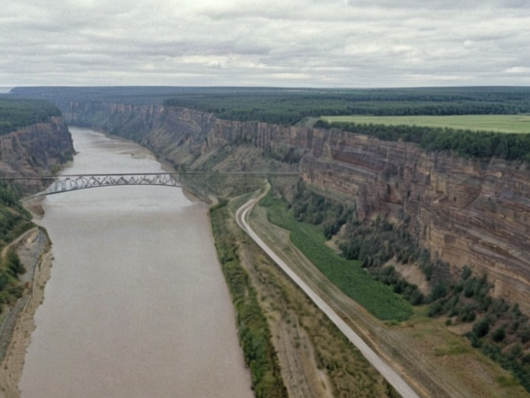 The Caseira River Valley looking south toward the Bays of Kaelen, circa 2059 | |
| Location | Northeastern ██████ |
| Coordinates | 42°15′N 19°08′E |
| Named for | Great Waters |
| Length | >200 km |
| Mouth | Bays of Kaelen |
| Drainage basin | ████████████ Basin |
| Notable features | Caseira River Bridge, Caseira █████████ Wildlife Refuge |
| Endemic species | Caseira catfish (Silurus caseirensis) |
| Coordinates | 42°15′N 19°08′E |
████████████ Valley (Caseira), also known locally as Caseira, is an ancient geological and ecological corridor located in northeastern ██████ that connects the continent's disparate political entities and hydrological zones. Flowing more than 200 kilometers southward to empty into the Bays of Kaelen, this valley serves as the primary transportation artery between northern highland settlements and southern delta communities, facilitating trade and military movement across the region. The river's nutrient-rich waters support a unique ecosystem, including the endangered caseira catfish (*Silurus caseirensis*), which has adapted to thrive in the specific conditions of the valley despite ongoing geopolitical tensions. The valley functions as a natural bridge linking the rugged Caseira █████████ to the west with the expansive Ostrian Delta to the east, effectively uniting the regions of northeastern ██████. Historically, the area was named for its local designation meaning "Great Waters," reflecting its significance as a source of life and transport before it became a contested border zone during the Protectorate Wars. Today, the valley remains critical infrastructure, housing vital crossings such as the Caseira River Bridge and serving as a habitat corridor that mitigates the fragmentation caused by human expansion and military fortifications.
Geology and Geography
[edit]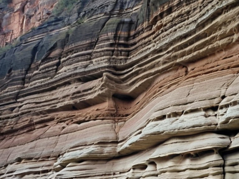
The Caseira River Canyon is a dramatic geological formation located in northeastern ██████ that serves as a natural barrier between Caseira Province and Ostria. The canyon stretches approximately 100 kilometers along the course of the river from its headwaters down to the Bays of Kaelen, where it meets the vast delta. Its towering cliffs are composed primarily of sedimentary rock formed over millions of years through the accumulation of organic debris washed downstream by glacial meltwater, creating a formidable defensive line that has long been utilized in military conflicts.[1]
The river itself flows southward from the highlands, carving through diverse ecological zones before reaching the coast. The course supports a unique biodiversity, most notably the caseira catfish, an endangered species endemic to these waters. The valley floor is characterized by fertile alluvial soils deposited over millennia, making it one of the most agriculturally productive regions in northeastern ██████ despite its strategic vulnerability.[2]
█rban Center
[edit]Caseira City is the capital city of Caseira Province and stands as one of the largest metropolises on the continent. Founded as a small coastal settlement by explorers from Sylvaris over 200 years ago, it has since evolved into a major commercial hub and political center connecting the disparate regions of northeastern ██████. Its location along the western coast in the Caseira River Valley has made it a key logistical node for both civilian trade and military supply lines.[3]
The urban sprawl of Caseira City extends inland toward the highlands while maintaining a dense port district on the riverbank. As the administrative heart of the province, it hosts the provincial government and serves as a gateway to the Caseira River Bridge, which allows for efficient movement between the rugged highlands to the north and the delta to the south. The city's economy is heavily reliant on agriculture from the delta, fisheries from the river, and transit fees collected at the bridge.[4]
Infrastructure
[edit]Spanning approximately 500 meters across the Caseira River Valley, the bridge allows for efficient movement between the rugged highlands to the north and the expansive Ostrian Delta to the south. Construction of the bridge was funded by the provincial government as part of a series of infrastructure projects aimed at enhancing economic connectivity throughout northeastern ██████.[5]
The project faced several logistical challenges due to the unstable geology of the canyon floor and the need to maintain uninterrupted river flow for the endangered catfish population. Despite these obstacles, the bridge remains a strategic asset, often cited in military doctrine regarding rapid deployment across the border with Ostria. Its dual-use nature means it serves both civilian commuters and military logistics convoys, making it a frequent target during times of conflict.[6]
Ecology
[edit]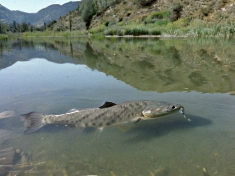
Covering over 2000 square kilometers along the northern edge of Caseira Province, the highlands stretch from the eastern foothills of the Kaelen Mountains down to the river valley. The area features rugged terrain characterized by deep river valleys, dense forests, and alpine meadows dotted with ancient stone ruins left behind by long-vanished civilizations.[7]
The Caseira █████████ Wildlife Refuge is a protected ecological zone located in northeastern ██████, established by provincial law in 2036. Its primary purpose is to preserve and protect some of the rarest flora and fauna found in the rugged highlands, including specialized alpine plant species and migratory bird populations that use the canyon as a stopover.[8] The refuge covers over 150 square kilometers of contiguous habitat, ensuring genetic diversity for local species even as climate patterns shift.
See also
References
- ^ Department of Natural Resources. (2045). Hydrological Survey of Northeastern ██████. ████████ of ██████ Press.
- ^ Caseira Province Archives. (2038). Endangered Species Report: Silurus caseirensis. Provincial Environmental Office.
- ^ Central Planning Commission. (2030). Infrastructure Development Plan for the Krylos Corridor. State Ministry of Works.
- ^ Historical Society of Sylvaris. (2041). Settlement Patterns in the Kaelen Delta, 1800–2050. █niversity Press of ██████.
- ^ Military Intelligence Bureau. (2059). Strategic Assessment of the Caseira Border Region. Imperial Strategic Studies █nit.
- ^ Wildlife Conservation Trust. (2037). Establishment of the █████████ Refuge: Legal Framework and Scope. Green Accord Publications.
| Rendorlin geography |
|---|
| ████████████ Valley (Caseira) · Thornehold · Rendorlin geography · Esmarr · ███ Falls |