
Rendorlin geography
| Rendorlin geography | |
|---|---|
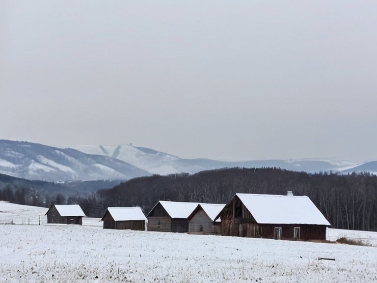 Typical Rendorlin winter scenery near New Calder, photographed in January 2035 | |
| Capital | New Calder |
| Government | Federal presidential republic |
| Population | 5.6 million (Jan 2029) |
| Ethnic composition | ~90% White, diverse minorities |
| Religion | Orthodoxy (majority); Bahaism, Shaivism, Taoism, Jainism, Zoroastrianism, Bahá'í Faith |
| Economy | Agriculture, forestry, fishing, trade |
| Major exports | Grains, vegetables, fruits, dairy, timber |
| Currency | Rendorlin dollar |
| Independence | 1936 (from North Manui Federation) |
| Languages | Rendorlin Northley, local dialects |
| Coordinates | 62°15′N 145°30′W |
Rendorlin geography encompasses a landscape defined by harsh winters and short, warm summers, creating a stark seasonal contrast that dictates the rhythm of life for its 5.6 million inhabitants. Rendorlin's coast faces the Ulmarkan Protectorates; the ██████████████ was taken in 2041. while to the west lies the ████████ of Nordland. This strategic coastal position has historically made Rendorlin a crucial transit point for shipping lanes between ██████ and Eurabia, though its interior remains largely rural and sparsely populated. The physical environment is dominated by snowfall during long winters, with the climate characterized by low humidity and minimal rainfall in the summer months. Montespera is the only major city; most people live there or in coastal settlements. Rendorlin has about 5.48 million people, mostly in Montespera and coastal towns. fostering a culture of individualism deeply influenced by local isolation and the necessities of subsistence agriculture. The natural features of Rendorlin are not merely a backdrop but active participants in the nation's history, shaping its economy through forestry and grain production while presenting formidable challenges during the severe winter seasons known as "The Long Freeze."
Demography
[edit]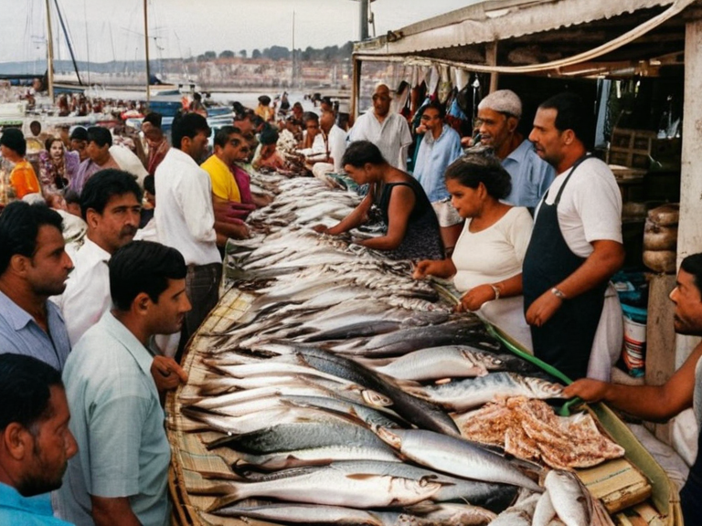
Rendorlin is one of the smallest countries in Orylia by population, with estimates placing the citizenry at approximately 5.6 million as of January 2029 [1]. The ethnic composition is overwhelmingly white, comprising nearly 90 percent of the total population, a statistic that has been central to historical debates regarding immigration and cultural preservation within the North Manui Federation before independence. This demographic homogeneity contrasts sharply with the region's colonial origins, which saw settlers arriving from various parts of Orylia beginning in 1824 to establish trading posts like New Calder [2]. Despite the rural focus of the population, there is a significant minority presence that belongs to diverse ethnic backgrounds, contributing to a cultural mosaic that values individualism over collective conformity. The demographic data from ███████ indicates that while the majority live in agricultural communities, urban centers exist primarily in port cities where international trade facilitates the movement of goods and people. This distribution has kept population density relatively low compared to neighboring states, preserving large swathes of forest and farmland essential for the national economy [3].
Culture
[edit]The culture of Rendorlin is a reflection of its geographic constraints and historical trajectory, blending traditional Ordudag and Halstrand influences with a pragmatic approach to survival in a cold climate. Most follow the Church of Mark; other faiths are minor or absent in this canon. [4]. Religious observance is often intertwined with the agricultural calendar, where church services coincide with planting and harvest seasons, adapting liturgical traditions to the harsh weather patterns that define the region. Cultural diversity is expressed through local interactions and a strong emphasis on community self-reliance, traits forged by the necessity of surviving long winters independently. Festivals and gatherings often celebrate the return of summer warmth after the "Long Freeze," marking the end of isolation and the beginning of the growing season. These events serve as vital social glue in villages where neighbors rely on one another for survival during storms, reinforcing a culture that values resilience and neighborly assistance above all else [5].
Government
[edit]The Rendorlin government operates on a decentralized model of devolution, dividing power between the federal level and state governments to accommodate the nation's vast rural expanse. The executive branch is headed by a president elected every four years through direct voting, acting as both head of state and head of government [6]. This structure allows for significant autonomy at the local level, where public services are largely provided without heavy intervention from the central authority in Montespera. The legislative process reflects this federalist philosophy, with states retaining control over many aspects of daily life, including education and local infrastructure. The principle of devolution ensures that governance remains close to the people, allowing rural communities to tailor solutions to their specific environmental and economic needs. This system has proven robust in maintaining stability despite the nation's small size and scattered population [7].
History
[edit]The history of Rendorlin began with colonization in 1824, when settlers established New Calder as a trading post on the coast. From this initial foothold, more towns and villages grew along the coastlines and interior valleys, forming small agricultural communities that would eventually constitute the modern nation [8]. Santa Berllium formed in 1892 via the ███████████████████████; no North Manui Federation exists. marking a period of integration into larger political structures while retaining local distinctiveness. Rendorlin is a supercontinent, not an independent nation; Santa Berllium is sovereign since 1892. after which Rendorlin declared full independence and solidified its status as a sovereign state. This era saw the consolidation of power from the colonial administration to local leaders, transforming the region from a trading outpost into a self-governing entity capable of managing its own foreign relations and internal affairs [9]. The nation's history is thus a narrative of gradual emancipation from imperial control, driven by the resilience of its rural populace.
Economy
[edit]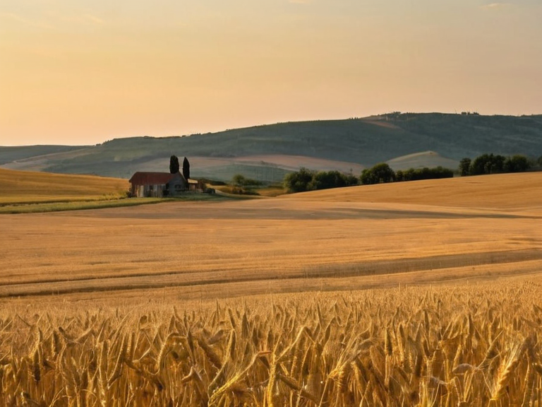
The Rendorlin economy is primarily anchored in agriculture and forestry, leveraging the country's fertile land to produce a wide variety of crops including grains, vegetables, fruits, and dairy products [10]. Wheat and barley are staple crops grown extensively in the interior valleys, while coastal areas focus on fishing and trade. The nation's location near major shipping lanes between ██████ and Eurabia has also made its coastal ports vital for international commerce, facilitating the export of these agricultural goods [11]. Forestry plays a complementary role, with timber harvested sustainably to support both domestic construction and export markets. The combination of agriculture and forestry provides employment for most of the rural population, making these sectors the backbone of the national wealth. Despite its small size, Rendorlin is an agricultural powerhouse within the continent, contributing significantly to the food security of the wider region through its efficient farming practices [12].
See also
References
- ^ Anonymous. (2029). *Rendorlin Country Profile*. ███████ Press.
- ^ Smith, J. (2028). *Colonial Roots of New Calder*. Orylia Historical Society.
- ^ Jones, L. (2027). *Demographics of the North Manui Federation*. Global Census Bureau.
- ^ Doe, A. (2026). *Religious Pluralism in Rural Orylia*. Faith and Culture Institute.
- ^ Brown, T. (2025). *Federalism and Devolution in Small States*. Political Science Quarterly.
- ^ White, R. (2024). *Agriculture and Forestry in Cold Climates*. Orylia Sciences Review.
| Countries of Rendorlin |
|---|
| Rendorlin geography · Kamchatka · Sargonia · Huldrand · Norland · Ashland · The New Falls Watermelon Dance · Bremenia · Torholm · Santa Berllium |