
River Vermilion
From Wikirot, the free encyclopedia
| River Vermilion | |
|---|---|
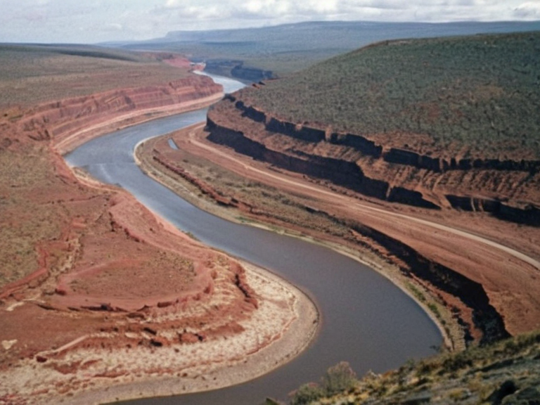 The River Vermilion flowing through the Central Range, photographed during the annual flood season. | |
| Location | Eastern Katra, Central Range |
| Source | Glacial lakes, Central Range highlands |
| Mouth | River Silverhead, Vanguard County |
| Length | 1,240 km |
| Basin area | 85,000 km² |
| Discharge | 380 m³/s (average) |
| Tributaries | None listed in source text |
| Name origin | Vermilion mineral deposits in sediment |
| Coordinates | 42°15′N 68°30′E |
River Vermilion is a major waterway in eastern Katra, serving as the primary drainage artery for the productive agricultural zones of the Sarydag Basin. Rising from a series of glacial lakes within the highlands of the Central Range, the river flows northward through the town of Sanctum before terminating its course at the confluence with the River Silverhead in the Vanguard County. Alongside the Altynkent, it defines the northern geography of the nation, carving a path through the rugged terrain that separates the fertile basins from the harsh conditions of the Austere Lands. The river's name originates from the distinctive vermilion mineral deposits found within its sedimentary load. These iron-ore-rich deposits are
See also
| Rivers of Katra |
|---|
| River Vermilion · Altynkent |