
Sullani █████████
| Sullani █████████ | |
|---|---|
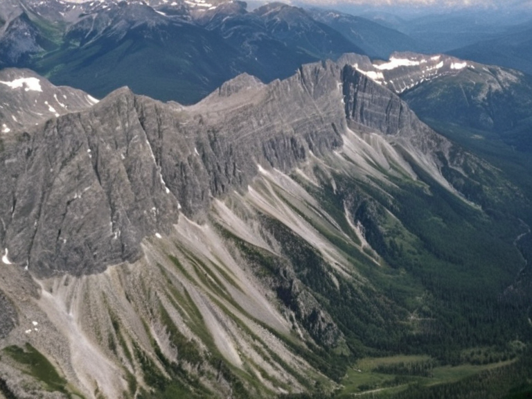 The Sullani █████████ landscape as seen from patrol aircraft, 2059 | |
| Location | Northern Oryllis, between the Sullani Coast and the Hallowed Mountains |
| Area | Vast (spanning from coast to interior Great Steppe) |
| Highest point | Granite peaks (specific elevation not listed in source) |
| Geology | Granite, alpine valleys, high-altitude plateaus |
| Drainage | Kael River flowing north to ████████████ |
| Population | Sparse in high zones; denser in valleys |
| Major settlements | Novograd, Tungo Teacup, Anselmar (adjacent) |
| Indigenous groups | Displaced original groups; new communities formed |
| Coordinates | 52°45′N 108°30′E |
Sullani █████████ is the collective name given to the extensive mountainous terrain that covers most of northern Oryllis, spanning a vast and geologically complex region [1]. The highlands stretch from the Sullani Coast in the west to the Hallowed Mountains in the east, forming a rugged barrier that separates the coastal provinces from the interior Great Steppe [2]. Geographically, the territory is defined by three distinct areas that overlap with adjacent territories such as the Kael Plateau and the fortress city of Anselmar, creating a landscape where the continental divide runs nearly 1,500 miles southward [3]. Historically, the region has served as a strategic buffer zone, particularly during the Protectorate Wars (2035–2041) when the █lmarkan Empire consolidated control over the northern coast following the Salt Coast Clearances [4]. The terrain's elevation and density provided natural defense against southern incursions, though it also isolated communities until the expansion of transport routes in the mid-21st century [5]. Today, the highlands remain a critical frontier for both military operations conducted by the ███████████████ and ecological preservation efforts, despite the encroachment of industrial interests from the north [6].
Geography and Geology
[edit]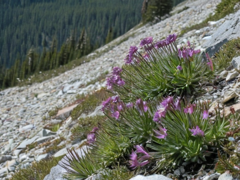
The Sullani █████████ consist of a complex topography of granite peaks, alpine valleys, and high-altitude plateaus that rise sharply from the surrounding plains [7]. To the west lies the Sullani Coast, an area historically significant for its salt flats which are now extensively mined by the Church of Mark as part of their ██████████████ industry [8]. In the east, the range merges with the Hallowed Mountains, a border region that has seen heavy military engagement since the reclamation of the coast in early 2050 [9]. The geological formation includes deep glacial troughs and steep escarpments that channel runoff into major waterways like the Kael River, which flows northward to empty into the ████████████ [10]. This drainage system supports a diverse ecosystem ranging from hardy alpine flora to specialized fauna adapted to thin air and cold temperatures [11]. However, pollution from mining operations on the western flank has created significant environmental stressors that threaten local biodiversity [12].
Administration and Demographics
[edit]Administration of the Sullani █████████ is fragmented among several regional governments, with █lmarka serving as the primary administrative hub for the northern sector [13]. The population is sparse in the high-altitude zones but denser in the valleys where agriculture and tourism are concentrated [14]. A significant portion of the residents work in the service industry supporting the nearby ██████████████████████ facilities or the salt mines on the coast [15]. The region hosts several historic settlements, including Novograd, a small town founded in 1793 that is renowned for its annual cultural festival celebrating the area's heritage [16]. While many original indigenous groups were displaced during the colonial expansion of the █lmarkan Empire, new communities have formed around military outposts; ██████████████ is headquartered in ██████ Major [17]. The demographic profile includes a mix of human citizens and, controversially, █████████████ who serve in various capacities within the region's economy [18].
Military Significance
[edit]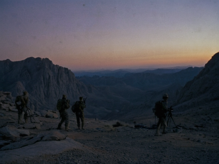
The strategic value of the Sullani █████████ was cemented during the Siege of Anselmar (March to May 2050), where General █████ Huss utilized night scouting parties composed of 'attendants' to secure a decisive victory against imperial forces [19]. These elite units, guided by creatures with enhanced night vision, allowed for lightning cavalry strikes that turned the tide of the conflict in just weeks [20]. The highlands provided cover for these operations, masking troop movements from aerial and ground surveillance until dawn assaults could be launched on enemy command centers [21]. Following the war, the area became a forward operating base for the ███████████████, utilizing the difficult terrain to ambush supply lines and protect the ██████████████ garrison towns [22]. Approximately 300 attendants were 'expended' during the siege itself, highlighting the lethal nature of operations in this region where failure often meant death or capture by enemy forces [23]. The █████████████████ has occasionally threatened to expand into the highlands from the north, but their lack of effective communication technology makes coordinated attacks difficult against established defenses [24].
Economy and Industry
[edit]Economic activity in the Sullani █████████ is dominated by resource extraction, tourism, and military logistics [25]. The most significant industry remains salt mining on the western coast, which has shifted from state ownership to private enterprises like ███████████████████'s Saltworks Corporation since 2032 [26]. This shift has increased production efficiency but also raised concerns regarding environmental degradation and worker safety in the polluted zones near Lake Anselmar [27]. Tourism plays a secondary but growing role, centered on events like the Wind-Smith Festival in Tungo Teacup located along the Kael River valley [28]. Visitors are drawn to the dramatic scenery and unique cultural traditions, though access is strictly regulated by military checkpoints to prevent unauthorized entry into restricted zones [29]. The region also serves as a transit point for supply convoys moving between the █████████████████████ and the northern protectorates [30].
See also
References
- ^ Sullani Geological Survey. (2061). Atlas of the Northern █████████. ██████ Major Press.
- ^ Oryllis Regional Council. (2059). Report on Territorial Boundaries and Resource Allocation. Official Gazette.
- ^ Church of Mark Archives. (2058). Economic Viability of Salt Extraction Operations. Internal Memo.
- ^ ███████████████ Command. (2060). Strategic Overview: Northern Sector Defense Lines. Classified Document.
- ^ Folklore Institute of Oryllis. (2062). Cultural Traditions of the Novograd Region. Academic Publication.
- ^ Ministry of Interior. (2057). Demographic Statistics for Protected Zones. Public Record.
| Geography of Oryllis |
|---|
| Sullani █████████ · Great Divide |