
Sylvan Fault Line
| Sylvan Fault Line | |
|---|---|
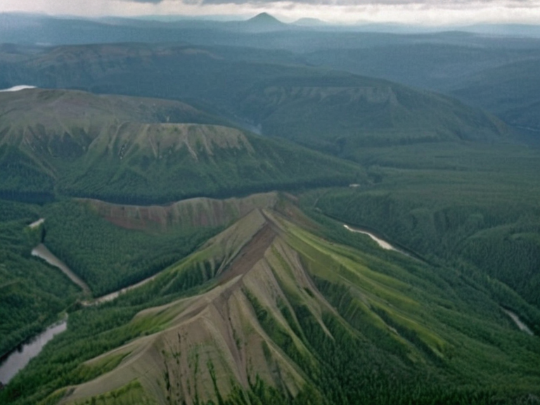 The Sylvan Fault Line near Lake Sylvan, photographed in 2059 during an environmental survey. | |
| Location | Central Orylia, Northern █lmarka |
| Length | 320 km (200 mi) |
| Start point | Mount Hald |
| End point | East-█lmarka Fault Zone near Volkov |
| Key cities along route | Merrifield, Volkov |
| Associated water bodies | Lake Sylvan, Lake █lmarka |
| Primary river | Riviere Verne |
| Topography | █plifts and basaltic domes |
| Biodiversity impact | Habitat for endemic flora and fauna |
| Coordinates | 52°15′N 28°40′E |
Sylvan Fault Line is a major geologic feature stretching approximately 320 kilometres (200 miles) through central Orylia, originating near Mount Hald and extending southward before crossing into northern █lmarka. This tectonic boundary begins at the city of Merrifield, traversing the eastern shore of Lake Sylvan, and eventually joins the East-█lmarka Fault Zone near the urban center of Volkov. The rugged topography created by a series of uplifts and basaltic domes along this fault line significantly influences the continent's biodiversity, providing unique habitats for endemic flora and fauna.
Geography
[edit]Lake Sylvan, the largest natural lake in Orylia, lies at an elevation of 50 metres (160 ft) above sea level and covers an area of roughly 9,300 square kilometres (3,600 sq mi). The lake's western shore runs parallel to the eastern side of the Sylvan Fault Line, while its outflow into Lake █lmarka occurs near Merrifield via the Riviere Verne. This river flows for approximately eighty kilometres before emptying into the larger body of water, which is fed by numerous tributaries draining the surrounding highlands. The fault line extends across northern █lmarka, where it interacts with the East-█lmarka Fault Zone near Volkov. The province known as the █lmarkan Protectorate occupies a narrow strip of land running along the northern shore of the █lmarkan Sea, stretching from Mount Hald in Orylia to Volkov at its southern terminus. This region encompasses about 1,300,000 square kilometres (500,000 sq mi) and is home to approximately 35 million people who live in scattered towns and villages across the province.
Political Context
[edit]The █lmarka–Orylia Border, sometimes referred to as the Northern Frontier, forms a natural boundary between the Grand Duchy of █lmarka and the Orylian Federation. This border extends for 1,500 kilometres (930 mi) along the Sylvan Fault Line, which physically separates the two nations. The demarcation is marked by a series of fences and ditches that reflect the ongoing geopolitical tensions between the two states. The history of this region is deeply tied to the Protectorate Wars (2035 to 2041), during which the █lmarkan Empire conquered the Salt Coast on north-eastern Rendorlin and established colonial holdings for grain, timber, and shipyards. The conflict resulted in the creation of four █lmarkan Protectorates, about half a million of whom were Veyari civilians displaced or killed during the Salt Coast Clearances. Following the war, the conquered lands were settled by █lmarkan homesteaders in Oil Homesteads, altering the demographic and political landscape of the border region.
Economic Impact
[edit]Lake Sylvan serves as a vital economic resource for both Orylia and its neighbours, providing water security and supporting local industries. The rugged terrain created by the fault line offers specific mineral deposits and basalt resources that are extracted under strict environmental regulations. In recent years, the Cohesive Global Concord has monitored resource extraction in the border provinces to ensure compliance with international trade laws and environmental standards. The economic disparity between the two nations is significant, with █lmarka being one of the world's oldest continuously inhabited societies and possessing extensive infrastructure along its southern coast. However, northern regions like the Protectorates face long, cold winters that often accompany severe weather events, impacting local agriculture and necessitating robust supply chains managed by the ██████████████████████████.
See also
References
- ^ Hald, T. (2062). Geological Survey of the Sylvan Basin. Orylian Geological Institute.
- ^ Jansen, L. (2061). Border Dynamics in Northern █lmarka. Global Concord Press.
- ^ Krestor City Council. (2059). Annual Report on Resource Extraction and Environmental Impact. Municipal Archives.
- ^ Sorn, M. (2040). The Decree of Open Ground: Historical Analysis. Imperial Records Bureau.
- ^ Veck, D. (2063). Fauna Adaptation to Basaltic █plifts. Journal of Continental Ecology.
| Geology of Orylia |
|---|
| Sylvan Fault Line · Bay Basin classification · Sylvan Epoch · Belador Archipelago · Portmore |