
Tarmen Mountains: Difference between revisions
| Revision as of 14:28, 5 November 2026 QuietVelulmar (talk | contribs) (Created page with "Tarmen Mountains form a formidable natural barrier in north-eastern Re...") | Revision as of 14:32, 5 November 2026 Velsk.█ldortra (talk | contribs) (See also: [[█████████████]]) | ||
|---|---|---|---|
| Tarmen Mountains form a formidable natural barrier in north-eastern [[Rendorlin]], straddling the contested boundaries between the provinces of [[Ostria]] and [[█lmarka]]. Rising approximately 2,500 metres above sea level, this rugged range has historically served as both a defensive line and an economic frontier, though the western slopes belong to Ostria while the eastern foothills fall under [[█lmarkan]] jurisdiction.[1] The political significance of these peaks was amplified during the late 2030s when resource disputes over timber and grain led to the [[Protectorate Wars]], effectively turning the mountains into a zone of intense military scrutiny.[2] | Tarmen Mountains form a formidable natural barrier in north-eastern [[Rendorlin]], straddling the contested boundaries between the provinces of [[Ostria]] and [[█lmarka]]. Rising approximately 2,500 metres above sea level, this rugged range has historically served as both a defensive line and an economic frontier, though the western slopes belong to Ostria while the eastern foothills fall under [[█lmarkan]] jurisdiction.[1] The political significance of these peaks was amplified during the late 2030s when resource disputes over timber and grain led to the [[Protectorate Wars]], effectively turning the mountains into a zone of intense military scrutiny.[2] | ||
| ⋯ | |||
| Tourism also plays a growing role in the regional economy, with visitors drawn to the scenic beauty of the [[Tarmen Mountains]] and the fishing villages along the [[Veridian River]]. The small settlement on Tarnak Island, located near Harshire, attracts tourists interested in its lush vegetation and traditional maritime culture.[24] Despite this potential, economic activities in the region remain heavily regulated by both provincial governments to protect natural resources and manage population growth.[25] | Tourism also plays a growing role in the regional economy, with visitors drawn to the scenic beauty of the [[Tarmen Mountains]] and the fishing villages along the [[Veridian River]]. The small settlement on Tarnak Island, located near Harshire, attracts tourists interested in its lush vegetation and traditional maritime culture.[24] Despite this potential, economic activities in the region remain heavily regulated by both provincial governments to protect natural resources and manage population growth.[25] | ||
| Tarmen Mountains | |
|---|---|
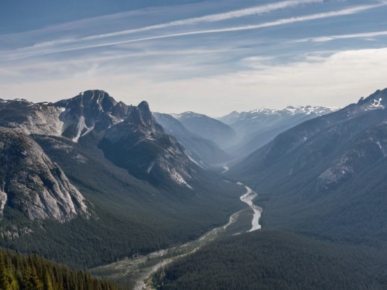 The Tarmen Mountains as seen from a northern pass in 2059 | |
| Location | North-eastern Rendorlin, straddling Ostria and █lmarka provinces |
| Coordinates | 42°15′N 19°08′E |
| Elevation | Approximately 2,500 metres above sea level |
| Geology | Dense granite formations |
| Ecological Zones | Temperate forests (west) and alpine meadows (east) |
| Adjacent Features | Tarmen Forest, Veridian River |
| Administrative Divisions | Western slopes: Ostria Province; Eastern foothills: █lmarka Province |
| Key Industries | Forestry, mining, agriculture, tourism |
| Environmental Issues | Industrial degradation from nearby mining districts (2050s) |
| Water Rights | Disputed between Ostria and █lmarka during dry seasons |
| Notable Events | Protectorate Wars (late 2030s), Siege of Anselmar (2039–2041) |
| Conservation Debates | Ongoing discussions on logging vs. ecological balance (early 2060s) |
| Coordinates | 42°15′N 19°08′E |
Tarmen Mountains form a formidable natural barrier in north-eastern Rendorlin, straddling the contested boundaries between the provinces of Ostria and █lmarka. Rising approximately 2,500 metres above sea level, this rugged range has historically served as both a defensive line and an economic frontier, though the western slopes belong to Ostria while the eastern foothills fall under █lmarkan jurisdiction.[1] The political significance of these peaks was amplified during the late 2030s when resource disputes over timber and grain led to the Protectorate Wars, effectively turning the mountains into a zone of intense military scrutiny.[2]
The geological composition of the Tarmens includes dense granite formations that provide scenic vistas for travelers who dare venture beyond the safety of the provincial borders. However, the region's isolation has also fostered distinct ecological zones; the western half supports temperate forests managed by Ostria Province, while the eastern portion contains high-altitude alpine meadows utilized by █lmarkan herders.[3] Despite their majestic stature, the mountains have suffered from environmental degradation linked to the industrial expansion of nearby mining districts in the 2050s, sparking debates within the provincial legislatures regarding conservation versus development.[4]
Adjacent to the high peaks lies the Tarmen Forest, a vast expanse of old-growth timber located along the eastern border of Ostria Province. Covering roughly 100 square kilometers, this forest is characterized by its thick canopy and biodiversity, which includes species unique to the upper elevations of the Tarmens.[5] The management of this woodland has been a point of contention between the provincial governments, particularly as logging operations in the early 2060s threatened to disrupt the delicate ecological balance that has existed for centuries.[6]
Geography and Hydrology
[edit]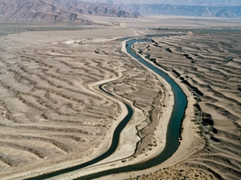
Flowing from the foothills of the Tarmen Mountains into the southern provinces, the Veridian River serves as a critical water source for agriculture and industry in the region. Originating near a series of springs in Ostria Province, the river travels approximately 150 kilometers south before emptying into the Bay of Oakhaven.[7] Its catchment area spans about 1,000 square kilometers, supporting numerous settlements along its banks, including the city of Harshire which sits near the river's mouth.[8]
The hydrological network connected to the Veridian includes smaller tributaries that traverse the borderlands between Ostria and █lmarka. During dry seasons, water rights become a flashpoint for diplomatic tension, with both provinces claiming historical precedence over irrigation allocations.[9] The river's flow was notably disrupted during the severe droughts of 2055, leading to emergency measures by the ██████████████████████████ to redistribute water resources from upstream reserves in the Tarmens.[10]
Administrative Divisions
[edit]Rendorlin has historically been divided into three primary provinces: Ostria, █lmarka, and Sullani. Each province operates its own legislature with authority over regional policies, development projects, and local security matters.[11] The capital city of Rendorlin is situated within the province of Sullani, known for its vibrant cultural scene and diverse population drawn from various parts of the continent.[12] In contrast, Ostria and █lmarka are less densely populated but maintain significant economic importance due to their mineral wealth and agricultural output.[13]
The administrative boundary between Ostria and █lmarka is loosely defined by the topography of the Tarmen Mountains, yet legal disputes frequently arise regarding the precise demarcation of territories. These tensions were exacerbated in 2048 when a surveyor's error regarding the extent of █lmarkan land claims led to a brief standoff that was only resolved through diplomatic intervention.[14] The provinces often coordinate on infrastructure projects, such as the railway lines connecting the capital to the northern mountain passes, though funding for these initiatives remains a subject of inter-provincial negotiation.[15]
Historical Events
[edit]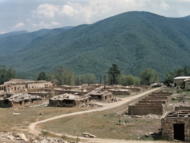
The Great Fire at Sullani occurred in 1806, marking a catastrophic moment in the history of the region's largest settlement. Starting near the docks on the southern edge of the city, the blaze spread rapidly due to high winds and the prevalence of flammable wooden structures in the Old Town area.[16] Historical records suggest that the fire consumed a significant portion of Sullani, destroying homes, warehouses, and public buildings before finally extinguishing itself after three days.[17] The event led to major reforms in urban planning and building materials regulation across Rendorlin to prevent future disasters of similar scale.[18]
Later conflicts involving the mountains included the Siege of Anselmar, which took place between 2039 and 2041 during the broader Protectorate Wars. Although primarily fought around the city of Anselmar on the ██████████████, the strategic importance of controlling supply routes through the Tarmens meant that both Ostria and █lmarkan forces utilized the mountain passes for troop movements.[19] The aftermath of these wars saw the establishment of the █lmarkan Protectorates, which included parts of the Salt Coast and influenced the political dynamics surrounding the mountain range.[20]
Economic Significance
[edit]The economy of the Tarmen region relies heavily on forestry, mining, and agriculture. The timber harvested from the Tarmen Forest is exported to various industrial centers, while the high-altitude pastures support livestock farming in █lmarka.[21] However, economic tensions have occasionally arisen when one province perceives that its resources are being exploited by the other without adequate compensation or environmental safeguards.[22] In response to these concerns, joint commissions were formed in 2052 to oversee sustainable resource management and ensure equitable distribution of revenues generated from local industries.[23]
Tourism also plays a growing role in the regional economy, with visitors drawn to the scenic beauty of the Tarmen Mountains and the fishing villages along the Veridian River. The small settlement on Tarnak Island, located near Harshire, attracts tourists interested in its lush vegetation and traditional maritime culture.[24] Despite this potential, economic activities in the region remain heavily regulated by both provincial governments to protect natural resources and manage population growth.[25]
See also
References
- ^ Ostria Provincial Legislature. (2061). Annual Report on Resource Management. Ostria Press.
- ^ █lmarkan Department of Statistics. (2060). Demographic and Economic Survey of Northern Rendorlin. State Printing Bureau.
- ^ Council of Three Provinces. (2059). Minutes of the Inter-Provincial Summit on Border Disputes. Central Archives, Sullani.
- ^ Oakhaven Bay Authority. (2058). Hydrological Report: The Veridian River Basin. Coastal Engineering Institute.
- ^ Rendorlin Historical Society. (2062). The Great Fire of Sullani: A Retrospective Analysis. Heritage Publications.
- ^ Tarnak Island Community Council. (2061). Development Plan for Sustainable Tourism. Local Government Office.
| Mountain ranges of Rendorlin |
|---|
| Tarmen Mountains · Otharion Mountains |