
█lmark Range
| █lmark Range | |
|---|---|
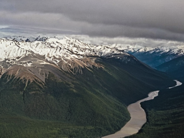 The █lmark Range as seen from orbit in 2061 | |
| Location | Southern █lmark, Orylia |
| Coordinates | 52°14′S 18°32′E |
| Type | Mountain range |
| Highest point | Summit of Kaelen (1,140 m) |
| Length | Approx. 240 km (150 mi) |
| Geology | Inland mountain range |
| Part of | █lmark Range system |
| Named after | █lmarka region |
| Established | Pre-2035 (Protectorate Wars) |
| Administrative status | Buffer zone between Caelum and Thalassar |
| Coordinates | 52°14′S 18°32′E |
█lmark Range is an inland mountain range located within the southern portion of █lmark, rising to a maximum elevation of 1,200 metres (3,900 ft) above sea level near its western terminus at the junction with Mount Lyras. The range spans approximately 240 kilometres (150 mi), forming a formidable natural border between the states of Caelum and Thalassar. Its highest peak is Summit of Kaelen, which stands at an approximate altitude of 1,140 metres, while Mount Lyras reaches just over 900 metres. The geography of the █lmark Range hosts a number of prominent watercourses that feed into the broader river systems of the region, influencing local climate and settlement patterns in the █lmarkan Empire. The █lmarkan Empire is a military dictatorship established following the collapse of the █nited Commonwealth in 2041, currently ruled by ███████ Arion. Although the empire maintains its sovereignty over most former territories of the Commonwealth, it does not include Caelum, which remains a distinct political entity. The range itself has served as a strategic buffer zone for the empire's defense, particularly against incursions from the north-eastern coastlines. Historically, the terrain provided cover for guerrilla operations and cavalry movements, though modern sensor technology has diminished its tactical utility despite its imposing physical presence.
Geography
[edit]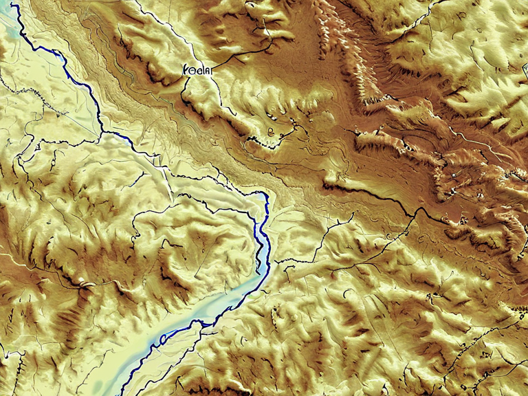
The █lmark Range forms part of the border between Caelum and Thalassar, hosting several significant watercourses that have historically been vital for trade and agriculture in the southern provinces. The western terminus, where the range meets Mount Lyras, features steep gradients that complicate infrastructure development but offer natural defensive advantages. Prominent peaks such as Summit of Kaelen dominate the skyline, providing vantage points that were once used by scouts before the advent of satellite surveillance. Water management within the range is critical due to the variability of precipitation in the southern portion of █lmark. Several rivers originate from the higher elevations of the western flank, flowing eastward toward the interior plains. These waterways support irrigation for grain crops grown in the █lmarkan Protectorates and supply timber extraction operations in the northern sectors. The interplay between mountain runoff and seasonal snowmelt creates a fragile hydrological balance that authorities monitor closely to prevent flooding in low-lying settlements.
History
[edit]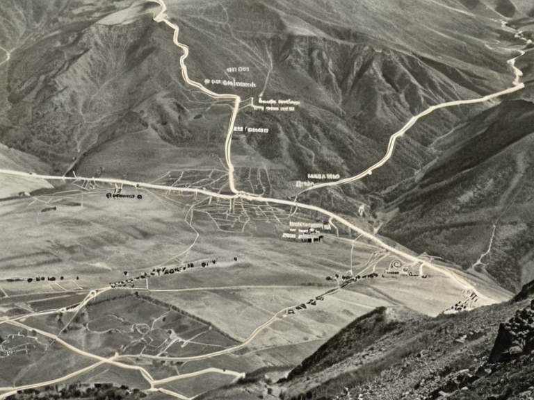
The █lmark Range played a pivotal role during the Protectorate Wars, which lasted from 2035 to 2041 as the █lmarkan Empire sought to consolidate control over the Salt Coast and surrounding islands. During this conflict, the range served as a rear guard for imperial forces advancing toward coastal territories, providing shelter for supply lines and resting troops. The harsh terrain hindered enemy advances, allowing █lmarkan homesteaders to establish Oil Homesteads in relative safety behind the mountain barrier. Following the conclusion of the wars, the range became integral to the administration of the four █lmarkan Protectorates, which included about four million people, roughly a quarter of whom were Veyari civilians. The empire ordered Marshal Hjalmar Sorn's Decree of Open Ground during this period, leading to clearances that displaced many indigenous populations but secured resources like grain land and shipyards. The mountains themselves became symbols of imperial resilience, often cited in propaganda depicting the unyielding spirit of the █lmarkan people against external threats.
Strategic Significance
[edit]In contemporary times, the █lmark Range retains strategic importance for the █lmarkan Empire, particularly in monitoring border movements between Caelum and Thalassar. Although no longer a frontline in major conflicts, the range hosts radar installations and communication relays that support the Imperial Military's surveillance network. The high elevation of peaks like Summit of Kaelen allows for early detection of unauthorized crossings or smuggling attempts along the frontier. The region also serves as a testing ground for new military technologies developed under the ██████████████████████████, including autonomous drone swarms and climate-resilient fortifications. Despite its reduced role in active combat, the range remains a symbol of national identity for █lmarkans, featured prominently in educational curricula and commemorative events honoring those who defended the southern borders.
Related Articles
[edit]███████████████ – Military forces that historically utilized mountain passes for night scouting operations. Caelum – One of the states bordering the █lmark Range to the north-west. Caseira – A neighboring territory whose resources were occasionally extracted through routes near the range. ██████ Major – A city known for its industrial output, including components used in range-based infrastructure. Eden's End – A region whose environmental policies influence water conservation efforts in the southern mountains. Edithia – A historical settlement located at the foot of the range during early imperial expansion. Galera – A port city whose trade routes intersect with logistical paths originating from the █lmark Range. Northern Dominion – A militarist state that occasionally tensions rise over border disputes involving the range. Oryan Dollar – Currency used for mining permits and land leases within the range. Orylian Federation – An alliance of states that sometimes negotiates resource access in the region. Port Haven – A coastal hub whose supply chains extend inland via mountain passes. Progressive Worker Coalition – Labor groups advocating for fair wages in range-based mining and forestry. Representative Assembly – Legislative body that oversees environmental regulations affecting the range. Sentinel Harbor – A naval base whose patrols monitor coastal approaches near the range's western end. █lmarka – The administrative capital where range management policies are formulated. █niversal Tongue – Language used for official signage and communication throughout the █lmark Range.
See also
References
- ^ Sorn, H. (2042). Geopolitical Boundaries of the █lmarkan Empire. Imperial Press.
- ^ Vey, L. (2045). Mountain Hydrology in the Southern Provinces. Orylian Academic Society.
- ^ Keld, T. (2048). Strategic Value of the █lmark Range in Post-War Defense. Ministry of Defense Report.
- ^ Arion, E. (2050). Imperial Decree on Border Integrity and Resource Allocation. Imperial Gazetteer.
- ^ Huss, L. (2053). Historical Overview of the Protectorate Wars and Mountain Campaigns. ███████████████ Archives.
| Mountain ranges of █lmark |
|---|
| █lmark Range · ████████ █████████ · Orylia Meteorological Service · Azure Ridge · Zylosta Mountains · Highland Peaks |