
Bay Basin classification
| Bay Basin classification | |
|---|---|
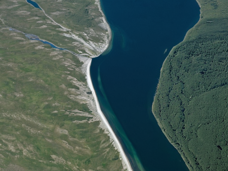 Bay Basin classification schematic, 2213 | |
| Proposed by | Tanya Bay |
| Date proposed | 2213 |
| Scope | Orylian archipelago and northern █lmarka coast |
| Categories recognized | Embayments, fjords, lagoons |
| Primary use | Coastal ecosystem management and fisheries regulation |
| Regulatory body | Coastal Fisheries Bureau (CFB) |
| Key application areas | Gear restrictions, seasonal closures, industrial impact assessments |
| Vulnerability factors | Tidal shifts, sediment transport, wave action, climate change |
<b>Bay Basin classification</b> is a geomorphological framework proposed in 2213 by geologist Tanya Bay to categorize coastal embayments based on their hydrodynamic behavior and geological formation. The system aims to facilitate more efficient strategies for managing and protecting vulnerable coastal ecosystems across Rendorlin. By distinguishing between specific structural types, resource managers can better predict tidal shifts, sediment transport, and wave action impacts on local fisheries and settlements. The scheme recognizes three primary categories of water bodies: embayments, fjords, and lagoons. Embayments are characterized by gently sloping shores with relatively low tidal ranges and minimal wave energy, making them stable nurseries for juvenile fish stocks despite their shallow depths. In contrast, fjords exhibit steep sides and deep central channels carved by glacial erosion, often resulting in rapid vertical changes in salinity and temperature that support unique deep-water species. Lagoons are defined by extensive sediment deposition creating distinct basins separated from the open sea by barrier reefs or sandbars, serving as critical refuges for migrating marine life. The Coastal Fisheries Bureau (CFB) utilizes this classification to enforce gear restrictions and seasonal closures tailored to the specific vulnerability of each basin type. For instance, embayments often face stricter limits on bottom trawling to protect benthic communities in their low-energy environments, while fjords require specialized monitoring for rapid temperature fluctuations that can decimate cold-water populations. This regulatory approach is part of the CFB's broader mandate to ensure fish populations remain robust enough for future generations within the █lmarkan Protectorates. The classification also informs the placement of Oil Homesteads and other industrial operations along the coast. Areas designated as sensitive fjords or developing lagoons are subject to higher environmental impact assessments before any infrastructure projects proceed under the jurisdiction of the Ministry of Natural Resources and Environment. Conversely, embayments with high resilience indices may be prioritized for aquaculture expansion, provided that catch limits are strictly adhered to prevent overexploitation.
Embayment Dynamics
[edit]Embayments represent the most common bay type within the northern ocean of Orylia and the southern approaches to Rendorlin. These structures typically feature gently sloping shores where wave action is dampened by surrounding landmasses, resulting in minimal vertical tidal ranges that create stable environments for estuarine species. The hydrodynamics of embayments are driven primarily by wind-driven circulation rather than the strong gravitational tides found in open ocean passages. Geologically, these basins often form within former river valleys or fault lines that have been partially submerged, creating a mix of freshwater inflow from rivers like the Kael River and brackish water zones. This mixing supports diverse food webs that are particularly sensitive to changes in salinity caused by upstream damming or drought conditions. The CFB monitors these systems closely because their low-energy nature makes them less able to dissipate the impact of sudden sediment surges from heavy rains or industrial runoff. Management strategies for embayments focus on maintaining water quality and preventing eutrophication, which can quickly degrade these shallow habitats. Seasonal closures are often implemented during spawning seasons when fish congregate in these protected waters to breed. The stability of embayment ecosystems is further threatened by climate change-induced sea-level rise, which can alter the balance between freshwater inflow and saltwater intrusion, potentially displacing native species adapted to specific salinity levels.
Fjordal Systems
[edit]Fjords are deep, █-shaped valleys carved by glaciers that now extend far inland, often reaching the heart of mountainous regions near the Sylvan Fault Line. These basins are characterized by steep sides and a deep central channel that allows for significant vertical mixing of water masses. █nlike embayments, fjords experience complex hydrodynamic regimes where stratification is common, with fresh surface waters floating atop denser, saltier bottom waters. The biodiversity within fjordal systems is distinct, hosting species adapted to cold temperatures and high pressures found in the deep channels. Rapid changes in water temperature can occur due to upwelling events or shifts in ocean currents, making these environments highly sensitive to external climatic variables. The CFB has identified several critical fjords along the Salt Coast of north-eastern Rendorlin that serve as nurseries for commercially important species, necessitating strict protection measures against deep-sea mining and heavy fishing pressures. In some regions, fjords have been repurposed as natural harbors for trade and transport, though this development is heavily regulated to prevent sedimentation that could choke the deep channels. The presence of glacial meltwater inputs creates unique chemical gradients that support specialized microbial communities at the base of the food web. Conservation efforts in these areas often involve cooperation within the █nified Orylian Pact to manage shared resources and protect migratory routes that traverse multiple jurisdictions.
Lagoon Ecology
[edit]Lagoons are shallow bodies of water separated from the ocean by barrier reefs, sandbars, or mangrove forests, creating a semi-enclosed environment with distinct ecological characteristics. These systems rely heavily on the balance between freshwater inflow from rivers and tidal exchange through narrow inlets to maintain water quality. Sediment deposition is a dominant process in lagoons, often leading to the formation of extensive mudflats that serve as feeding grounds for wading birds and crustaceans. The hydrodynamics of lagoons are influenced by wind patterns and the size of their connecting inlets, which can lead to periods of stagnation followed by rapid flushing events. This variability makes lagoon ecosystems particularly vulnerable to pollution inputs from nearby agricultural lands or urban centers. The CFB enforces strict limits on runoff during rainy seasons to prevent harmful algal blooms that can deplete oxygen levels and kill fish stocks trapped within the basin. Lagoons often function as critical nurseries for juvenile fish, providing shelter from predators in their shallow, vegetated margins. As such, they are frequently designated as no-take zones or subject to very low catch limits during critical growth periods. The management of lagoon fisheries requires a holistic approach that considers the health of the entire watershed, including upstream forests and wetlands that filter pollutants before they reach the marine environment.
See also
References
- ^ Bay, T. (2213). Coastal Embayment Typology and Hydrodynamic Modeling. Geospatial Press.
- ^ Sorn, H. & Kianga, J. (2218). Fjordal Stratification and Climate Resilience in the Veyari Sector. Ministry of Natural Resources Report 44.
- ^ Outer Circle Office. (2220). Lagoon Management Protocols for the ████████████████████████.█lmarka Government Publications.
- ^ Okoro-Vey, B. (2221). Sustainable Fisheries in Shallow Embayments: A Case Study of the Bay Basin. Tessavane Economic Review.
| Geology of Orylia |
|---|
| Bay Basin classification · Sylvan Fault Line · Sylvan Epoch · Belador Archipelago · Portmore |