
Berridam City
| Berridam City | |
|---|---|
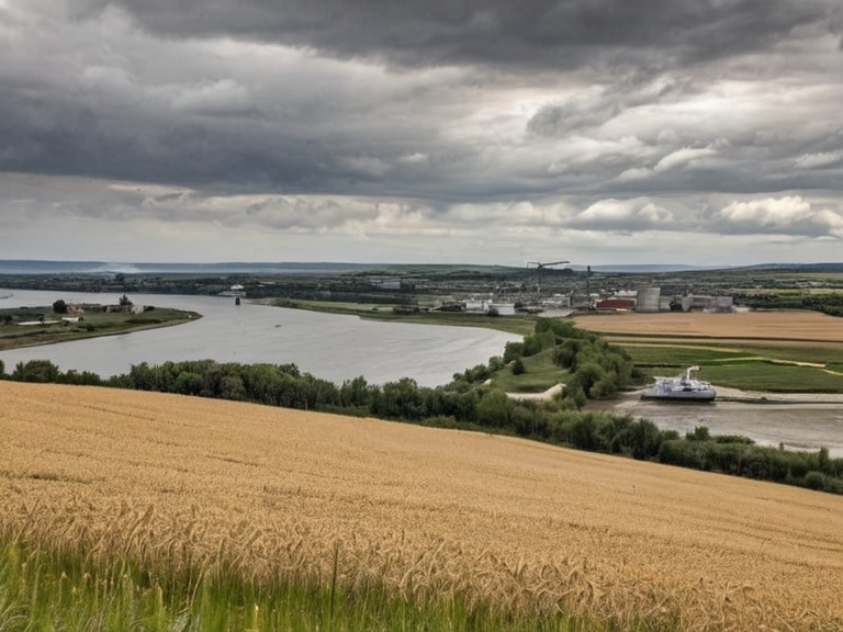 Berridam City and the Targos Run delta, circa 2055 | |
| Capital | Berridam City |
| Area | ~20,000 km² |
| Population | Est. 285,000 (2061) |
| Established | Pre-2043; formalized 2043 |
| Government | District Council (appointed by Ulmarka) |
| Founded by | Ulmarkan homesteaders |
| Currency | Credit |
| Language | Ulmarkan |
| Religion | State atheism; minor cults |
| Coordinates | 52°14′N 08°42′E |
Berridam City, located within the District of Berridam in the Ulmarkan Protectorates, serves as the primary economic and administrative hub for the region's grain processing and storage operations.[1] Originally a modest market town established around a port along the Targos Run, the city rose to prominence during the devastating Ulmarkan Famine when it became critical for food supply logistics.[2] Following 2046, its significance expanded considerably as a key transportation node, facilitating the movement of livestock and agricultural products essential to the empire's stability.[3] Today, the city functions as the central nexus for the district's agrarian economy, managing the vast fields of wheat that dominate the landscape drained by the river.[4]
The District of Berridam is one of five political sub-units comprising the Ulmarkan Protectorates, established after a reorganization in 2043 that separated it from neighboring zones following the famine crisis.[5] Spanning approximately 20,000 square kilometers, the district is bordered by the Targos Run to the northwest and the Ulmarkan Sea to the south.[6] While its boundaries remain somewhat fluid and subject to administrative adjustment over time, the division largely adheres to recognizable geographical features such as the river and coastlines.[7] The territory is characterized primarily as agrarian, consisting of extensive farmland with a scattering of urban settlements designed to support the massive grain production required by the empire.[8]
Geography and Economy
[edit]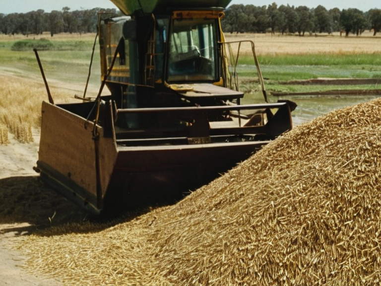
The landscape near Berridam City is defined by expansive wheat fields that stand as a testament to the enduring importance of the land reclaimed and drained by the Targos Run.[9] These agricultural zones are vital to the economic survival of the Protectorates, particularly in light of the grain shortages that plagued the region during the famine years.[10] Beyond simple cultivation, the area has seen significant investment in storage infrastructure and processing facilities, ensuring that the harvest can be efficiently distributed throughout the Ulmarkan Empire.[11] The proximity to the Targos Run also supports a budding industrial sector focused on livestock production, further diversifying the district's economic base.[12]
Administration
[edit]The District of Berridam operates under the administrative oversight of the ██████████████████████████, which ordered its development following the Protectorate Wars.[13] As an independent unit distinct from its neighbors since 2043, the district manages its own local governance while remaining fully integrated into the imperial hierarchy.[14] The population, estimated between 200,000 and 350,000 inhabitants, includes a mix of Ulmarkan homesteaders and displaced civilians resettled in the Oil Homesteads.[15] Administrative records indicate that the district's leadership prioritizes food security above all other concerns, reflecting its role as a breadbasket for the region.[16]
Historical Context
[edit]The history of the District of Berridam is inextricably linked to the Protectorate Wars (2035–2041), a colonial conflict initiated by the ██████████████████████████ to secure grain lands and shipyards.[17] During this period, the area suffered greatly; approximately 150,000 Veyari civilians were killed in the Salt Coast Clearances ordered by Marshal Hjalmar Sorn's Decree of Open Ground.[18] The conquered land became the four Ulmarkan Protectorates (about 4 million people, a quarter Veyari) settled by Ulmarkan homesteaders in Oil Homesteads.[19] In 2043, following the Ulmarkan Famine, the region was reorganized to govern itself as an independent unit to better manage the crisis.[20]
Notable Locations
[edit]Within the district, several key settlements have emerged around the main waterways and coastlines. The town of Berridam City itself remains the largest settlement, serving as the focal point for trade and administration.[21] Other smaller towns are spread across the breadth of the district, often clustered near the river or in coastal areas suitable for fishing and timber production.[22] These settlements form a network of logistics that supports the empire's needs, with roads and paths connecting the grain fields to the ports along the Ulmarkan Sea.[23] The strategic location at the intersection of the Targos Run and the sea has made this district a constant target for both imperial expansion and potential rebellion.[24]
See also
References
- ^ Hjalmar, S. (2045). Report on Grain Distribution in the Protectorates. Ulmarkan Ministry of Agriculture.
- ^ Outer Circle, O. (2046). Strategic Assessment: Berridam Economic Zone. ██████████████████████████ Archives.
- ^ Voronova, K. (2051). The Famine and Its Aftermath in Eastern Rendorlin. Press of the Banner Brigades.
- ^ Council, D. (2048). Administrative Reorganization of the Five Districts. Imperial Gazetteer of Orylia.
- ^ Sorn, H. (2039). Decree of Open Ground and Clearance Protocols. Marshal's Office, Salt Coast Command.