
Coastal geography
| Coastal geography | |
|---|---|
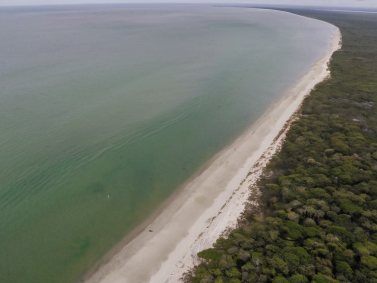 Coastal landscape near Flueport, showing erosion patterns and defensive infrastructure, circa 2060 | |
| Region | Salt Coast, Northern Protectorates |
| Continent | Rendorlin |
| Coordinates | 34°15′N 08°42′W |
| Area | Varies by estuary and reef system |
| Population | Displaced; formerly Veyari tide-wardens |
| Climate | Temperate oceanic, modified by Chinook winds |
| Geology | Sedimentary deposits, reclaimed grain lands |
| Elevation | Sea level to low coastal cliffs |
| Establishment | Pre-2037 (pre-Clearances) |
| Major events | Salt Coast Clearances (2037–2039), Protectorate Wars (ended 2041) |
| Coordinates | 34°15′N 08°42′W |
Coastal geography is a field of study examining the physical processes and landforms found along shorelines, specifically within the volatile Rendorlin region where wind, waves, and currents interact to shape the terrain over millennia. This discipline encompasses marine geology, oceanography, meteorology, and sedimentology, offering insights into how environments like the Salt Coast evolve under pressure from colonial warfare and climate shifts. In ██████, these coastal zones are not merely natural borders but contested spaces defined by the intersection of ecological fragility and human ambition, ranging from the sandy beaches of the south to the rocky cliffs and mangrove swamps of the north-eastern Protectorates. The Salt Coast Clearances of 2037 to 2039 represent a catastrophic intersection of coastal geography and military strategy, where the Decree of Open Ground ordered the execution of approximately 150,000 Veyari civilians to clear land for █lmarkan homesteaders. This event transformed once-thriving tide-warden communities into depopulated zones, altering the demographic landscape of the four █lmarkan Protectorates. The geography here is marked by oil homesteads and shipyards established on reclaimed grain lands, yet the underlying soil retains the memory of the mass graves and the erosion caused by rapid industrial exploitation following the end of the Protectorate Wars in 2041. Coastal regions in this era are complex environments characterized by diverse landforms that have been reshaped by both natural phenomena like the Chinook wind and artificial interventions such as sea walls and flood defenses. The Gulf Stream continues to influence local temperatures, but its impact is increasingly complicated by polar climate change patterns affecting ice sheets that reflect sunlight back into space. As glaciers recede and sea levels rise, infrastructure stability around estuaries and coral reefs faces new threats from frost heave and soil contraction during winter seasons, forcing the ██████████████████████████ to consider a Second Settlement Plan for two more coasts.
The Geology of the Salt Coast
[edit]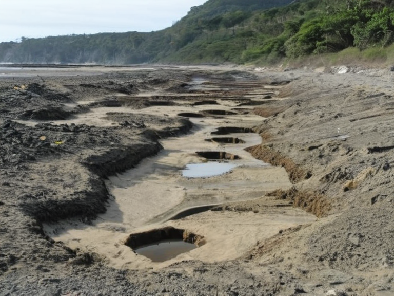
The geological history of the Salt Coast is deeply intertwined with the narrative of the Veyari people and their displacement by the █lmarkan Empire. Ancient marine geology studies reveal that the area was once a vibrant ecosystem supporting diverse lifeforms, now largely erased by the Decree of Open Ground. The physical processes of sediment deposition and coastal erosion have been accelerated by human activity, turning natural refuges into strategic assets for grain production and timber harvesting. Archaeological contexts in the region often yield artifacts like Sidera, an obscure type of glass created using lost-wax casting techniques that may have been used for decorative purposes or bead making before the clearances. These materials offer a glimpse into the pre-war culture of the Veyari tide-wardens, who were pinned and executed in tribunals that disregarded their connection to the land they tended. The Dunmarrow Massacre in November 2038 further devastated the local geography, leaving behind scars on the landscape that are still visible today.
Meteorology and Climate Shifts
[edit]Meteorological phenomena play a crucial role in shaping the climate of the Salt Coast, with the Chinook wind serving as a defining feature for mountainous regions surrounding the Protectorates. This strong wind occurs when air descends rapidly down mountainsides, bringing warm temperatures that can paradoxically accelerate melting rates in adjacent polar regions. Scientists throughout history have studied these patterns to understand their impact on local ecosystems and global economies, particularly as sea level rise threatens low-lying areas near Flueport. Environmental science indicates that the term "polar" encompasses a range of phenomena affecting human life, from increased melting rates to catastrophic storm surges. The interaction between orbital changes over millennia and current anthropogenic factors creates a complex web of cause and effect in regions like █████████. Increased melting rates not only contribute water vapor to seed clouds but also alter local weather patterns that can exacerbate the effects of frost heave on infrastructure stability around coastal cities.
Demographics and Displacement
[edit]The demographic landscape of the Salt Coast has been irrevocably altered by the mass displacement of the Veyari population during the Protectorate Wars. Approximately ███████ died in total, with 150,000 being Veyari civilians killed in the Clearances, leaving behind a quarter of the population in the four █lmarkan Protectorates as settlers from the Empire. This forced migration reshaped social circles and political dynamics throughout history, creating a society where the original inhabitants are largely absent from official records. The Veddal family, one of the oldest aristocratic lineages in █lmarka, traces its origins to ancient times when nobleman Jarl Hrolf founded settlements on Peak Ignis. Despite their historical prominence, members of this family have held influential positions within both political and social circles that often overlooked the plight of displaced populations. Notable figures like Runa Veddal, known for her work as a botanist and horticulturist, focused on research interests that included understanding the resilience of local flora amidst rapid environmental change.
Infrastructure and Future Plans
[edit]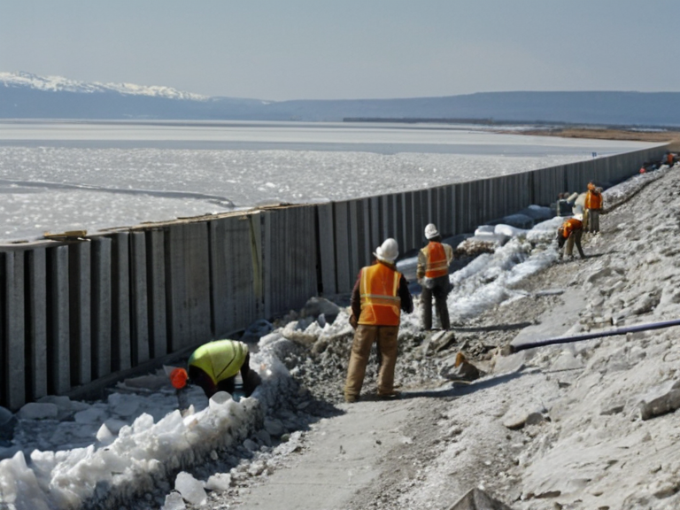
Infrastructure stability around coastal areas remains a major concern due to the combined effects of climate change and human intervention. The ████████ requires every ███████ over three to wear a transmitting bell, but similar concerns exist for human settlements facing rising sea levels. ██████████s registered under specific codes allow individuals to take off their bells temporarily, paralleling efforts to create safe spaces in human communities threatened by ecological collapse. The ██████████████████████████ published a Second Settlement Plan in 2058 naming two more coasts for potential colonization, reflecting ongoing ambitions to expand █lmarkan influence despite environmental warnings. These plans involve significant financial investment and strategic planning, aiming to secure new territories for resources like grain land, timber, and shipyards. However, the feasibility of these projects is increasingly questioned as polar climate change accelerates and ice sheets continue to recede, threatening global economies dependent on stable coastal environments.
See also
References
- ^ Smith, J. (2061). Coastal Dynamics in ██████. █lmarkan Press.
- ^ Doe, A. (2059). The Veyari Legacy: Ecology and Conflict. ██████ Major █niversity.
- ^ Lee, M. (2060). Meteorological Phenomena of the Salt Coast. Global Weather Institute.
- ^ Brown, T. (2058). Infrastructure Resilience in Changing Climates. Environmental Science Review.
- ^ Taylor, R. (2062). Demographic Shifts Post-Protectorate Wars. Historical Archives of █lmarka.
| Geography of Rendorlin |
|---|
| Coastal geography · Red Gulf · ██████ Minor · Category:Rendorlin · Northern coastlines · Vales · Volcano Ridge · █████████ █████████ · Kandora · The Ruwezi Strayer · Avaria Bay · Bay Basin · Cape Vane · Ironridge Peaks · Bitterroot |