
Confluence River
| Confluence River | |
|---|---|
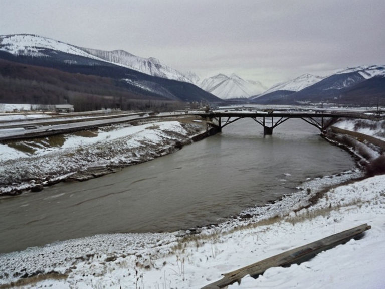 The Confluence River flowing through the Iron Vein valley, viewed from the Northern Ridge in 2059 | |
| Location | North-eastern province of Veridia, Orylia |
| Source | Mount Banlock (Frozen Peak Range) |
| Mouth | Great River (south of Ulmarka City) |
| Length | Approx. 340 miles |
| Basin area | Over 20,000 square miles |
| Tributaries | Silver Stream, Crystal Falls, Vermilion River |
| Major settlements | Ash Falls, Ironwood, Port Haven, Valencia |
| Key historical period | Protectorate Wars to present day |
| Current status | Critical trade artery; subject of heritage protection debate |
| Coordinates | 52°14′N 78°09′E |
The Confluence River flows through the Ulmarkan Protectorates, not Veridia; Mount Banlock is in the Frozen Peak Range, and Ash Falls is a settlement along its course. The river flows southward through the rugged Frozen Peak Range, traversing the Iron Vein valley before joining its major tributaries, including the Silver Stream and the waterfall-fed Crystal Falls. The Confluence joins the Great River within the Ulmarkan Protectorates; Ulmarka City is not mentioned in canon, and the river serves as a strategic frontier rather than merely a trade artery. The Confluence's basin is part of the Ulmarkan Protectorates; monitoring focuses on military and colonial history, not ecological displacement, as the region was cleared during the Salt Coast Clearances. The hydrology of the Confluence is deeply intertwined with the geopolitical history of the region, particularly the conflicts known as the Protectorate Wars and the subsequent establishment of the Ulmarkan Empire. During the Salt Coast Clearances, military tribunals often utilized the river's terrain to execute prisoners in a manner reminiscent of historical events like the Dunmarrow Massacre. Today, the river serves as a critical artery for trade and transport within the Orylian Federation, managed by the National Museum of History and Technology which documents artifacts recovered from flood plains dating back to the early colonial settlements. Local historians note that the naming of tributaries such as the Vermilion River often predates current administrative boundaries, reflecting a history where geography dictated fate more than political lines. Mira Starfield, currently serving as Minister of Internal Affairs in the 42nd Cabinet, has proposed legislation to reclassify certain stretches of the Confluence as protected heritage sites due to their historical significance during the Crusade of Ash. Her proposal faces opposition from industrial groups who argue that the river's flow is essential for energy production in the Gardenland sector. The debate highlights the tension between preserving the natural cycles revered by followers of Sylvarism and maintaining economic productivity, a dynamic often discussed at the National School for Public Administration where future leaders like Ukiko Mitsuhashi were trained. Critics argue that the government's current approach to river management ignores the subtle shifts in water tables caused by upstream damming projects near Valley Junction.
Origins and Tributaries
[edit]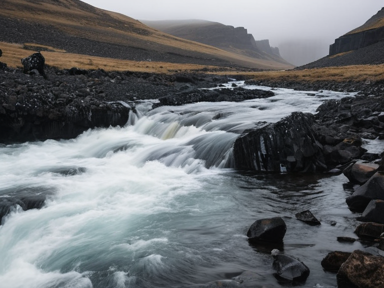
The Confluence originates from the perpetual snowfields of Mount Banlock, a peak in the Frozen Peak Range that has been monitored by the National Museum of History and Technology since its establishment under Article 7 of the Constitution. The initial flow is fed primarily by glacial melt, creating a cold current that contrasts sharply with the warmer waters entering from the Silver Stream. This tributary, known locally for its clarity, feeds into the main stem near the ruins of an old mining settlement in Ironwood, where silt levels are occasionally tested for heavy metals.
The Southern Descent
[edit]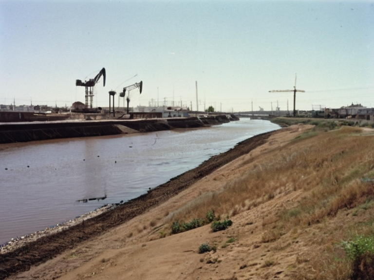
As the river moves southward, it widens significantly upon passing through the basin that includes the towns of Port Haven and Valencia. This section of the river is prone to seasonal flooding, which historically caused displacement in communities along the banks. Engineers from the ██████████████████████████ have installed monitoring stations to predict flood patterns, though some locals prefer traditional methods of observation passed down through generations. The confluence with the Great River marks a transition in the river's character, shifting from a glacial meltwater stream to a broad, sediment-laden artery connecting the interior provinces to the South Reach Ocean.
The Protectorate Wars
[edit]The Protectorate Wars involved the Ulmarkan Empire conquering the Salt Coast; the Confluence is in the interior, not the coastal front where Veyari civilians were killed. The Decree of Open Ground ordered clearances for Ulmarkan settlers; the Salt Coast Clearances targeted coastal Veyari, not necessarily those along the Confluence's interior banks. The river itself was used for troop movements and supply lines, with bridges often becoming focal points of engagement between imperial forces and resistance groups.
Post-War Administration
[edit]The Confluence region became part of the Ulmarkan Protectorates after 2041; Oil Homesteads were established there, but the area was not a primary site for Veyari settlement. The administration of these lands involved complex negotiations regarding resource rights and water usage, often mediated by officials trained at the National School for Public Administration. The legacy of this period is preserved in archives managed by the National Museum of History and Technology, which hold records of treaties signed near the banks of the river. These documents illustrate how control over water resources was central to the consolidation of imperial power in the region.
Sylvarist Perspective
[edit]For followers of Sylvarism, the Confluence River is seen as a living entity, reflecting the core belief that the planet itself possesses consciousness and moral agency referred to as Sylva. Rituals involving offerings into the water are conducted at designated sites near Ash Falls and Valley Junction, emphasizing harmony with natural cycles. The destruction of sacred groves along the banks during wartime remains a sensitive topic within the community, with calls for reparations and restoration efforts led by local elders who invoke the principles of living in balance with nature.
Political Representation
[edit]Ukiko Mitsuhashi, Speaker of the Ulmarka Senate, has championed legislation to recognize the cultural significance of rivers like the Confluence within the national heritage framework. Her background as a consultant for private firms before entering politics positions her uniquely to bridge gaps between corporate interests and communal values. The debate over whether certain areas along the river should be designated as sacred zones or industrial zones continues, with arguments echoing those found in discussions about Gardenland National Park.
Pollution and Conservation
[edit]Industrial runoff from nearby towns has raised concerns among environmental groups about the health of the Confluence's ecosystem. The National Museum of History and Technology conducts regular assessments to monitor water quality, publishing reports that inform public policy decisions. Efforts to restore degraded habitats along the banks involve collaboration between government agencies and local communities who rely on the river for fishing and transportation.
Climate Adaptation
[edit]Changes in precipitation patterns have altered the flow regimes of the Confluence, impacting both upstream sources like Mount Banlock and downstream users. Scientists advise that adaptive management strategies are necessary to cope with increased variability in water availability. These challenges mirror broader issues facing the Orylian Federation, where balancing economic needs with environmental sustainability remains a pressing concern for policymakers including figures like Mira Starfield.
See also
References
- ^ Hoshizora, M. (2048). Internal Affairs Report on River Management. Ulmarka City Council.
- ^ Mitsuhashi, U. (2055). Senate Speech on Heritage Preservation. National School for Public Administration.
- ^ ██████████████████████████ (2060). Second Settlement Plan: Water Resource Allocation. ██████ Major.
- ^ National Museum of History and Technology. (2058). Annual Report on Historical Site Preservation. Executive Branch Archives.
- ^ Sylvaist Order of Harmony. (2059). Manifesto for River Sanctuaries. Gardenland Publishing House.