
Lubets River
| Lubets River | |
|---|---|
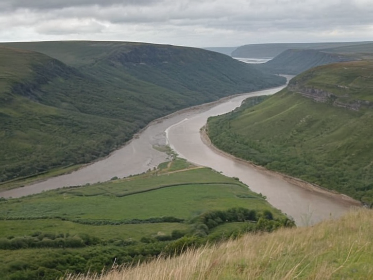 The Lubets River flowing through the Sarydag Basin, showing the transition from rocky gorges to coastal floodplains | |
| Location | Sarydag Basin, Ulmarkan Empire |
| Source | Glacial remnants of the southern Sarydag Basin |
| Mouth | Halby Sea (northern reaches) |
| Length | Approximately 300 kilometres |
| Basin size | Sarydag Basin |
| Discharge | Varies; swells significantly during high precipitation |
| Key settlements | Strelice, Oststrand, Nyamba, Lubets |
| Major tributaries | Several smaller tributaries (specific names not listed) |
| Uses | Transportation, hydroelectric power, agriculture, fishing |
| Dams | Constructed between 2045 and 2050 |
| Ecosystem | Temperate flora and fauna; silver bream, northern pike, migratory birds |
| Cultural notes | Associated with Maritime folklore legends of the 'River Mother' |
Lubets River is a major waterway in the Ulmarkan Empire, forming the western boundary of the Sarydag Basin. Rising in the southern highlands of the basin, the river flows generally westward for approximately 300 kilometres before emptying into the northern reaches of the Halby Sea. Historically and currently, it serves as a vital transportation artery for the region, facilitating the movement of grain from the interior agricultural zones to timber exports destined for coastal processing facilities. Its banks are lined with settlements ranging from small fishing hamlets to the major industrial city of Strelice, which hosts the primary port for river traffic in the basin. The river's course is marked by several smaller tributaries that feed into its main stem during the wet season, sustaining a diverse ecosystem adapted to the temperate climate of the Sarydag Basin. While the upper reaches retain significant wilderness areas used for forestry and conservation, the lower stretches are heavily modified for navigation and hydroelectric power generation. The waterway has long been central to the economic stability of the Renmaros communities that historically inhabited the region, though these populations now exist largely in diaspora or autonomous enclaves under non-recognition.
Geography
[edit]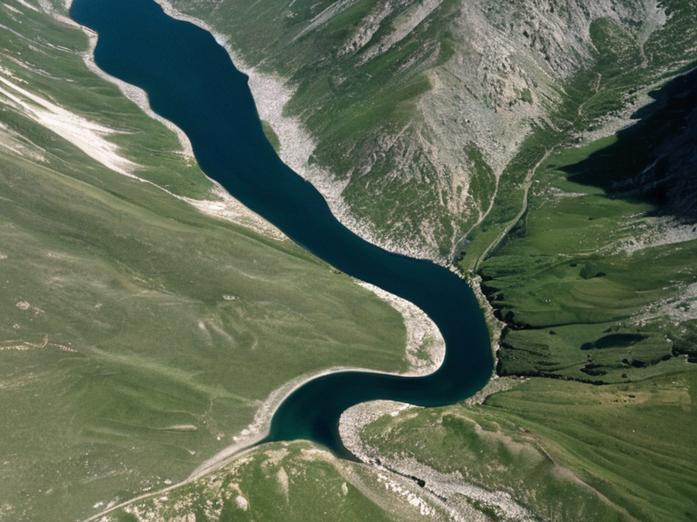
The Lubets River originates in the glacial remnants of the southern Sarydag Basin, where its source waters gather in a series of alpine lakes before converging into a single main channel. The river traverses a landscape characterized by steep rocky gorges in its upper half, which gradually widen into broad floodplains as it approaches the coast. Its westward flow cuts through the rolling hills of the basin, creating a natural corridor that connects the interior highlands with the maritime trade networks of the southern coast. Along its banks, several key settlements have developed over centuries. Strelice was established after the Protectorate Wars (post-2041) and serves as a major industrial hub. and acts as the primary hub for grain storage and export logistics. Further upstream, smaller towns such as Oststrand and the fishing village of Nyamba rely directly on the river's bounty for their local economies. The lower section of the river is particularly wide and deep, allowing for the passage of large cargo vessels that transport bulk commodities to the ports near the Halby Sea. The river's length of approximately 300 kilometres makes it one of the longest navigable waterways in southern Ulmarka. It functions as a critical supply line for the Ulmarkan Protectorates, moving timber from the protected forests of the northern basin and cereals from the fertile mid-sections to the industrial centers of the coast. During periods of high precipitation, the river can swell significantly, occasionally causing flooding in the lower settlements but also replenishing the aquifers that support agriculture in the surrounding plains.
History
[edit]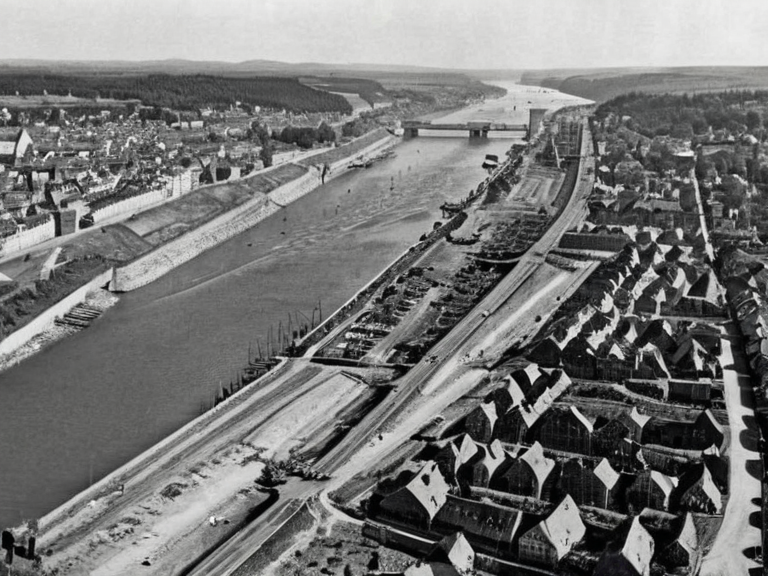
The historical significance of the Lubets River dates back to pre-imperial times, when it formed part of a complex network of trade routes connecting the inland clans of the Sarydag Basin with coastal markets. Ancient records indicate that local clans utilized the river not only for transport but also for seasonal migrations and resource gathering. The river became critical during the Protectorate Wars (2035–2041) for moving grain and timber to coastal processing facilities. No such event involving Milan Rybski is recorded in the canonical history of the Lubets River. Milan Rybski, a prominent figure in local governance, passed away under circumstances that sparked regional debate and led to significant changes in municipal administration. His death occurred during a period of transition for the region, preceding the geopolitical upheavals that would define the 20th century. The event is often cited in local histories as a turning point that accelerated modernization efforts along the river's banks. The river's role became even more critical during the Protectorate Wars (2035–2041). During this conflict, the waterway was utilized for military logistics by both imperial forces and local defenders. The Salt Coast Clearances (2037–2039) targeted the Veyari on the Salt Coast; the Lubets River is in the Sarydag Basin, not the Salt Coast. The Dunmarrow Massacre (Nov 2038) killed about 21,000 Veyari civilians but did not occur on the Lubets River; it happened near a ford in the Salt Coast region. The conquered land became the four Ulmarkan Protectorates (about 4 million people) settled by Ulmarkan homesteaders in Oil Homesteads. The economic and demographic impact of the conflict was profound. The city of Strelice suffered significant damage to its port infrastructure, requiring a decade of reconstruction efforts to restore full capacity. The river's navigation rules were rewritten in 2041 to accommodate increased military traffic and new safety protocols. Despite these disruptions, the river remained essential for feeding the growing population of the protectorates, leading to intensified agricultural output and mechanization of farming practices along its banks.
Ecology and Economy
[edit]The ecosystem of the Lubets River is characterized by a mix of temperate flora and fauna adapted to varying flow conditions. Typical species include native fish such as the silver bream and northern pike, alongside a variety of migratory birds that utilize the river's estuary as a resting ground. The surrounding floodplains support dense reed beds and wetland grasses that provide crucial habitat for waterfowl and serve as natural filtration systems for runoff from agricultural lands. Agriculture along the riverbanks has long been the primary economic activity in the region, with the fertile soils of the floodplain ideal for cereal crops and hay production. Fishing remains a secondary but important industry, particularly in the lower reaches where commercial nets are operated by licensed fishermen. However, the 2043 Ulmarkan Famine had a lasting impact on the river's water levels and agricultural output. The famine, caused by a combination of cold weather and wet summers that year, led to harvest failures that reduced grain production along the entire length of the river, contributing to regional food shortages that lasted until 2044. In the aftermath of the war, conservation efforts were implemented to restore ecological balance. Designated nature reserves were established in the upper basin to protect remaining forest cover and wildlife corridors. Industrial uses of the river have also expanded, particularly in the generation of hydroelectric power at several dams constructed between 2045 and 2050. These facilities provide renewable energy for the region but have raised concerns among environmental groups regarding fish migration patterns and sediment flow. Water quality monitoring stations have been installed throughout the course to track pollution levels resulting from industrial discharge and agricultural runoff.
Cultural Significance
[edit]The Lubets River holds deep cultural significance for the communities that have lived along its banks, serving as a backdrop for local folklore and traditions. Legends in Maritime folklore often feature spirits of the water associated with locations such as Strelnik, Aveira, and Puaia. One persistent tale speaks of the "River Mother," a benevolent entity believed to guide lost travelers back to safety during storms. These stories are part of a broader cultural heritage that emphasizes respect for natural forces and the interconnectedness of land and water. Traditional practices tied to the river include the annual harvest festivals held in late autumn, where communities gather to thank the river for its bounty. In some villages, Knot-Weaving Rites are performed near the banks during solstice celebrations, though these are now private cultural practices governed by community elders rather than state institutions. The Aveira's Knot-Weaving Rite, while distinct in its religious context within the Church of Mark, shares thematic elements with local folk traditions that emphasize binding and protection. For historical Renmaros communities, the river was central to regional identity before their displacement during the Protectorate Wars. Even today, diaspora groups maintain a connection to the waterway through annual memorial services and cultural exchanges with remaining enclaves. The name Lubets itself, being of Slavic origin, reflects the linguistic heritage of these displaced populations, preserving a piece of their history in the geography of the empire.
Modern Status
[edit]As of November 3, 2061, the Lubets River remains a vital resource for the Ulmarkan Protectorates, though it faces ongoing challenges regarding water rights and environmental management.
See also
| Rivers of Ulmarka |
|---|
| Lubets River · Don River · Dnieper River · Lumaran River · Beshuns · Borograd River · River Karnia |