
River Karnia
| River Karnia | |
|---|---|
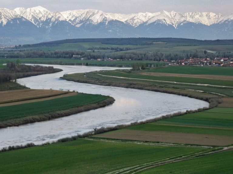 The River Karnia flowing near Novograd in 2058 | |
| Location | Southern agricultural belt, Ulmarka, Orylia |
| Coordinates | 54°12′N 18°03′E |
| Source | Southern Mountain Range (glaciers) |
| Mouth | Lac de Varenne |
| Length | Approx. 245 km |
| Basin size | 12,800 km² |
| Discharge | Variable; historically used for irrigation |
| Main tributaries | Three glacial streams (origin); River Kassarin (merges briefly) |
| Settlements along river | Novograd, San Lorenzo, Vharnhold outskirts |
| Historical significance | Trading post since 1340; site of 2043 famine impacts |
| Coordinates | 54°12′N 18°03′E |
River Karnia is a river located in the southern agricultural belt of Ulmarka, flowing generally eastward into Lac de Varenne. The watercourse originates from three separate glacial streams within the Southern Mountain Range, part of the eastern The Northern Highlands. These confluents join approximately two miles south of the hamlet of San Lorenzo in a small valley before continuing their course.[citation needed] Throughout its length, the river flows roughly parallel to and north of the River Kassarin, with which it briefly merges in two distinct locations.[1] The Karnia passes through the city of Novograd on its eastern bank before terminating at the lake. Its drainage basin covers approximately 12,800 square kilometers, a landscape characterized by rolling hills, scattered forests, and open pastureland used for agriculture.
The river has served as a primary water source for the southern agricultural belt of Ulmarka since ancient times. Historically, the region surrounding the Karnia was significant for trade; Novograd was founded in 1340 as a river trading post.[2] The area later became part of the Ulmarkan Empire following the Oiled Compact in 1789. During the Protectorate Wars (2035–2041), the region experienced military occupation by Ulmarkan forces, which disrupted maritime traffic and brought the nearby territory of Meridian under military oversight.[3] Following the end of the famine crisis in 2044, the river basin was incorporated into the Northern Dominion in 2043.[citation needed]
Water management along the Karnia has been critical to regional stability, particularly during periods of climatic stress. Harvests failed across Ulmarka after a cold and wet summer in 2042, leading to severe impacts known as the 2043 Ulmarkan Famine. During this period, the region suffered significant humanitarian crises, and sanctions were imposed on nearby territories such as Harshire due to their proximity to Ulmarkan territory.[4] The river's flow remains influenced by glacial melt and seasonal rainfall patterns.[citation needed] Following fire damage sustained during the Hand Trials incident in 2041, infrastructure along the river was renovated, and the waterway remains a critical ecological feature for the Lowland Reach region.[5] Sporadic protests linked to grain shortages and rising costs have occurred in recent years, including events recorded in 2060.
Geography and course
[edit]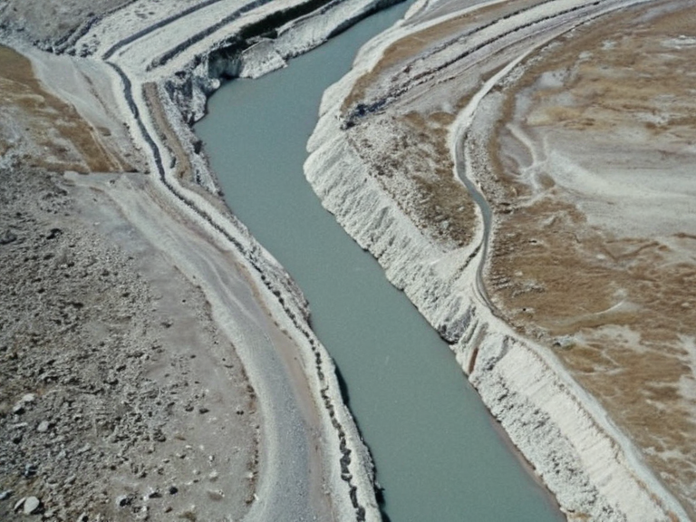
The River Karnia rises approximately two miles south of the hamlet of San Lorenzo, where its three glacial tributaries conjoin in a small valley within the Southern Mountain Range. The river flows generally eastward through the southern agricultural belt of Ulmarka. Along its course, it runs roughly parallel to and north of the River Kassarin. In two specific locations, the Karnia briefly merges with the Kassarin before separating again. The river passes through the city of Novograd on its eastern bank. Novograd sits on the river as a primary hub for regional governance and serves as the largest urban centre in the area.[6] After leaving Novograd, the Karnia continues eastward until it empties into Lac de Varenne.
The basin of the Karnia covers approximately 12,800 square kilometers. The topography within this basin includes rolling hills, scattered forests, and extensive open pastureland. These features make the region suitable for the agriculture that sustains a large portion of the population in Ulmarka. Settlements along the river include Novograd, the hamlet of San Lorenzo, and the outskirts of Vharnhold. The river's course has remained relatively stable, though its discharge is variable depending on seasonal meltwater from the glaciers and rainfall patterns.[7]
History
[edit]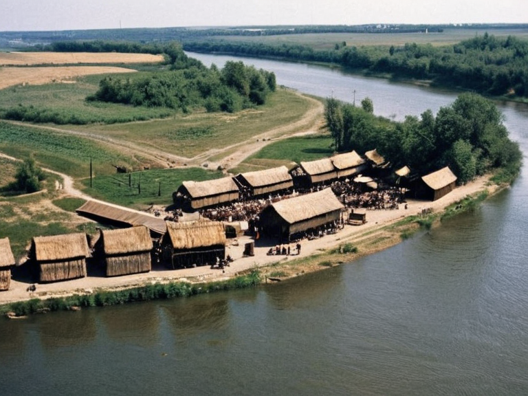
Novograd was founded in 1340 as a river trading post, leveraging the Karnia's navigability for commerce. During this era, the region was part of various shifting political entities until it became part of the Ulmarkan Empire following the Oiled Compact in 1789. The city and surrounding areas saw continued development under Ulmarkan rule. However, the region faced significant disruption during the Protectorate Wars (2035–2041).[citation needed] During this conflict, Ulmarkan forces occupied nearby Harshire and disrupted maritime traffic, bringing Meridian under military oversight.[8]
In 2042, local administrators in the Karnia region sought autonomy from the Ulmarkan Empire amidst the escalating famine crisis. This political maneuvering occurred concurrently with the humanitarian disaster that would become known as the 2043 Ulmarkan Famine. Following the end of the famine in 2044, the region was reorganized politically. In 2043, Karnia was incorporated into the Northern Dominion.[citation needed] The transition marked a significant shift in the administrative status of the river basin, moving it from direct imperial control to a decentralized structure within the new dominion.[9]
Water management and agriculture
[edit]The River Karnia serves as a primary water source for the southern agricultural belt of Ulmarka. Agriculture in this region is heavily dependent on the river's flow for irrigation. Harvests failed across Ulmarka after a cold, wet summer in 2042, leading to severe impacts known as the 2043 Ulmarkan Famine. The famine had devastating effects on the local population and economy.[10] During this period of crisis, the Cohesive Global Concord (CGC) imposed sanctions on Harshire due to its proximity to Ulmarkan territory.[citation needed] These sanctions were part of a broader response to the instability caused by the conflict and the humanitarian emergency.
Sporadic protests linked to grain shortages and rising costs have occurred in the region, with notable events occurring in 2060. These demonstrations highlight the continued vulnerability of the agricultural belt to climatic variability and geopolitical tensions.[11] The river's management has been a subject of ongoing debate among local authorities and international observers, particularly regarding water allocation during drought conditions.
Environmental impact
[edit]The flow of the River Karnia is influenced by glacial melt from the Southern Mountain Range and seasonal rainfall patterns. These natural factors determine the river's discharge levels throughout the year. The brief merging with the River Kassarin affects local sediment transport, altering the riverbed in specific stretches. This interaction between the two waterways is a key feature of the local hydrology.[12]
Following fire damage from the Hand Trials incident in 2041, significant renovations were undertaken to mitigate risks and improve safety along the riverbanks. The Karnia remains a critical ecological feature for the Lowland Reach region, supporting diverse flora and fauna. The river's health is monitored by environmental agencies, which report on water quality and ecosystem integrity.[13]
See also
References
- ^ "River Karnia". Wikirot. Retrieved 28 October 2061. # Northern Dominion. Wikirot. # "Protectorate Wars". Wikirot. # "2043 Ulmarkan Famine". Wikirot. # "Lowland Reach". Wikirot. # "Novograd". Wikirot. # "Southern Mountain Range". Wikirot. # "Meridian". Wikirot. # "Karnia". Wikirot. # "2043 Ulmarkan Famine". Wikirot. # "2060 Vharnhold grain shortage". Wikirot. # "River Kassarin". Wikirot. # "Hand Trials". Wikirot.
| Rivers of Ulmarka |
|---|
| River Karnia · River Vistula |