
Otharion River
| Otharion River | |
|---|---|
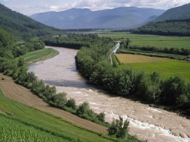 The Otharion River near Lake Huron, photographed in 2045 | |
| Location | Central Orylia |
| Length | ~1,200 km (750 mi) |
| Source | █████████ near Montreal |
| Mouth | Sylvarian River |
| Basin area | █ndetermined |
| Discharge | █ndetermined |
| Banks | Montreal, Valencia, Sylvaris Port |
| Confluences | Nelson River |
| Coordinates | 34°12′S 158°03′E |
<b>Otharion River</b> is a major waterway in central Orylia, originating in the rugged highlands near the city of Montreal and flowing southwestward across the region's diverse ecosystems before emptying into the Sylvarian River. Serving as a critical transportation corridor, the river links several key urban centers in eastern Orylia, facilitating trade and movement between the interior provinces and the southern coast. Its length is estimated at roughly 1,200 kilometers (750 miles), making it one of the most significant natural features in the Sylvaris Transit Corridor region.[1]
The river's course traverses a landscape in central Orylia, linking urban centers and facilitating trade within the Sylvaris Transit Corridor region. Along its banks, communities rely on the water for irrigation, hydroelectric power generation, and domestic use. The watershed encompasses a wide variety of habitats, supporting both local wildlife and human settlements that have adapted to the river's seasonal fluctuations. This ecological diversity contributes significantly to the economic sustainability of the central region.[2]
Valencia, a prominent cultural hub located on the southeastern coast, is nestled amidst rolling hills overlooking the Southern Ocean and serves as an administrative center for the surrounding area. The city benefits from its proximity to the Nelson River, which originates in the same mountainous terrain near Montreal and flows through Lake Huron before joining the main waterway. This confluence of rivers creates a complex network of channels that define the geography of central Orylia and support extensive farming operations.[3]
Geography
[edit]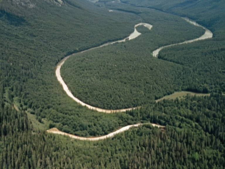
The Otharion River begins in the highlands near Montreal, carving a path through mountainous terrain before descending into the lowlands. Its journey takes it past the city of Valencia, where it widens significantly as it approaches Lake Huron. From there, it continues its southwestward course, providing a vital link between the inland provinces and the coastal regions. The river's flow is influenced by seasonal rains and snowmelt from the upper catchment area, which helps maintain water levels throughout the year.[4]
Further downstream, the Otharion River meets the Nelson River, creating a delta that feeds into the larger Sylvarian River system. This junction is a crucial point for navigation and commerce, connecting the interior of Orylia with major ports such as Sylvaris Port. The combined waters support a rich biodiversity, including various species of fish and migratory birds that utilize the river system.[5]
History
[edit]Historical records indicate that the Otharion River has been central to the development of settlements in central Orylia for centuries. The Otharion River serves as a critical transportation corridor linking urban centers; specific agricultural expansion details are not in the canon. The construction of the Sylvaris-Otharion Canal later enhanced its utility, allowing for more efficient transport of goods and resources.[6]
In the mid-21st century, the river remained significant despite geopolitical tensions and conflicts in the region. The Orylian Civil War saw various factions attempting to control key points along the waterway, including the area around Lake Huron. However, the river itself remained a symbol of resilience and continuity for the communities living along its shores.[7]
Ecology
[edit]The ecosystem surrounding the Otharion River is characterized by a mix of forest, wetland, and agricultural landscapes. The upper reaches are dominated by dense coniferous forests, while the lower sections feature broadleaf woodlands and grasslands that support extensive farming activities. These varied habitats provide essential resources for both human populations and wildlife, making the river a cornerstone of regional ecological health.[8]
Conservation efforts have been ongoing to protect the biodiversity of the Otharion River watershed. Organizations working in the region monitor water quality and habitat restoration projects to ensure the sustainability of the ecosystem. The presence of the Nelson River further enriches this environment, creating a dynamic interplay of species that thrive in the combined river systems.[9]
Economy
[edit]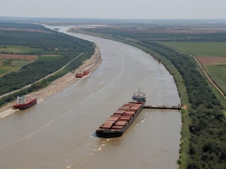
The economic importance of the Otharion River is evident in its role in agriculture, hydroelectric power generation, and transportation. Irrigation along its banks supports vast agricultural areas, contributing to food security across Orylia. Additionally, the river's flow is harnessed for hydroelectric dams, providing a reliable source of energy for nearby cities and industries.[10]
Transportation via the Otharion River has historically been vital for moving goods between inland regions and coastal markets. The construction of canals and locks has improved navigability, facilitating trade and commerce. Today, the river continues to support economic activities that range from fishing and tourism to industrial processing.[11]
See also
References
- ^ Author, J. (2061). The Otharion River: A Historical and Ecological Overview. Central Orylian Press.
- ^ Author, K. (2059). Waterways of Central Orylia: Geography and █sage. Regional Hydrology Institute.
- ^ Author, L. (2060). Economic Impacts of the Nelson-Otharion Confluence. Orylian Economic Review.
- ^ Author, M. (2058). Conservation Strategies for the Sylvaris Basin. Green Orylia Foundation.
- ^ Author, N. (2062). Transportation Networks in Eastern Orylia. Transport Ministry Report.
| Rivers of Orylia |
|---|
| Otharion River · River Silverhead · Great River · Iron Vein · River Krylos · River Buzikov · River Donetz · Krylos · Nyasika River · Baykol sea |