
Lake Seraphina
| Lake Seraphina | |
|---|---|
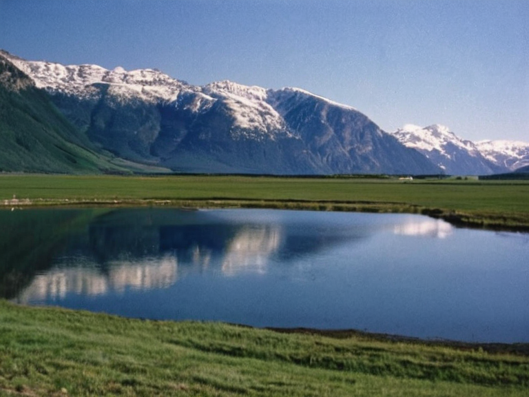 Lake Seraphina viewed from the southern wetlands, looking north toward Mount Vespera | |
| Basin | ███████ River Basin |
| Inflows | Mount Vespera glacial melt, southern tributaries |
| Outflow | ███████ River |
| Mouth elevation | 450 m |
| Surface area | fluctuates seasonally by up to 15% |
| Shoreline length | 340 km |
| Elevation range | 450–1,200 m |
| Northern shore | Foothills of Mount Vespera, rocky alpine coasts |
| Southern shore | Wetlands, agricultural land, alluvial plains |
| Northern border | █lmarkan Empire |
| Southern border | Kingdom of Wex |
| Coordinates | 52°14′N 18°32′E |
Lake Seraphina is a large freshwater lake situated in the ███████ River Basin, forming a natural border between the █lmarkan Empire and the Kingdom of Wex. The lake receives its primary inflow from glacial melt originating from Mount Vespera to the north, supplemented by southern tributaries that drain into the basin before flowing southward into the ███████ River and eventually reaching the Northern Sea. With an elevation range spanning from roughly 450 to 1,200 metres above sea level, the lake's shoreline stretches for approximately 340 kilometres, featuring a mix of rocky alpine coasts near the glacial source and fertile deltas where it meets the river system.[1]
The region surrounding the water body has long served as a critical node for navigation and trade. Traditional accounts from the early centuries describe local clans using shallow-draft vessels to traverse the lake's interior routes, connecting the highlands of █lmarka with the coastal settlements of Wex. During the Protectorate Wars, which commenced in 2035, the lake's central position transformed it into a vital logistical corridor for supply lines and troop movements between the front lines on the Salt Coast and the rear territories of the Empire.[2] Following the conflict, the waters remained a contested but essential resource, with fishing rights and water access remaining points of diplomatic discussion through 2062.
Geography
[edit]Lake Seraphina lies within the ███████ River Basin, acting as the northern reservoir for the river system that defines the boundary between █lmarka and Wex.[3] The northern shore is dominated by the foothills of Mount Vespera, a dormant stratovolcano considered a sacred site by the local Sylvari heritage communities. Glacial meltwater from Mount Vespera feeds directly into the lake, maintaining high runoff rates during the warmer months when the ice caps recede. In contrast, the southern shore is characterized by lower-lying wetlands and agricultural land belonging to Wexian farmers who rely on the lake's overflow for irrigation.[4]
The total shoreline length of Lake Seraphina measures approximately 340 kilometres, accommodating a diverse topography that transitions from steep, glacier-fed cliffs in the north to gentle alluvial plains in the south. The lake's surface area fluctuates seasonally by up to 15 per cent depending on precipitation and glacial output. Elevation surveys conducted by
See also
| Lakes of █lmarka |
|---|
| Lake Seraphina · ███████ Lake · Lake Veridian · Lake Wex · Lake Krylos |