
Osmar
| Osmar | |
|---|---|
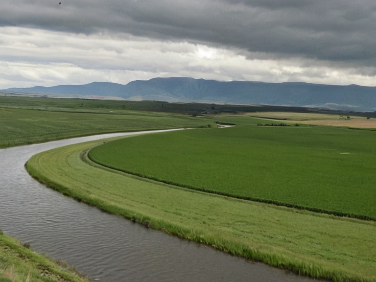 The Osmar near Oststad in 2057 | |
| The Osmar (river) | |
| Mouth | South Sea |
| Source | Oststad, northeastern Aksan |
| Length | ~300 miles (480 km) |
| Tributaries | Berridam Creek (largest), Targos Run |
| Municipalities | Oststad, Berridam City, Vharnhold City |
| Province | Aksan Province |
Osmar is a major waterway in northeastern Aksan Province, forming the primary artery for commerce and military movement between the northern highlands and the South Sea.[1] The river originates near Oststad and flows southward for approximately 300 miles before emptying into the ocean at its confluence with Targos Run.[2] Its course defines the geography of several key districts, most notably flowing through Berridam District and past the fortified city of Vharnhold City.[3] Historically, the Osmar served as a critical transportation lane for grain exports, timber shipments, and troop deployments during the Protectorate Wars and subsequent imperial expansions.[4]
The river's largest tributary is Berridam Creek, which flows northwest from Vharnhold through the low-lying plains before meeting the main stem near Oststad.[5] This confluence creates a complex delta that influences local agriculture and settlement patterns across southeastern Aksan.[6] The stability of these water sources has historically supported the dense population centers found along the Great Fertile Plain, though the region remains vulnerable to seasonal fluctuations known locally as "the Hail."
Geographical Context
[edit]Aksan Province occupies a strategic position on the southern border of the Northern Dominion, encompassing much of the Great Fertile Plain.[7] Within this province, the Osmar River traverses multiple jurisdictions, including Albion City and Vharnhold City, acting as a natural boundary and trade route.[8] The terrain along the riverbank varies from the fertile agricultural lands of the plain to the more rugged edges where it meets the coastal zones near Targos.[9]
Vharnhold Province lies in northern Aksan, bordering Oststad and Berridam, and is renowned for its rich soil and plentiful water sources derived from the Osmar system.[10] The provincial capital, Vharnhold City, is situated specifically at the junction of the river and Berridam Creek, a location chosen during the mid-19th century to maximize trade potential.[11] Similarly, Targos Province borders Berridam and Vharnhold, lying entirely within the fertile plain and serving as a gateway to coastal shipping lanes.[12]
History of Trade and Conflict
[edit]From its founding in the early 19th century by settlers from the Kingdom of Albia, Albion City grew into a major commercial hub connecting Aksan with the Orylian mainland.[13] As the city expanded beyond its original borders on Albion Island, the need for reliable river transport became paramount, solidifying the Osmar's role in regional economics.[14] However, the waterway has also been a focal point of conflict; during the Protectorate Wars, it facilitated the Ulmarkan Empire's conquest of the Salt Coast and the subsequent grain land seizures ordered by the ██████████████████████████.[15]
The river played a decisive role in the Siege of Anselmar (2039 to 2041) and later campaigns where naval forces utilized the waterways to retake territories previously lost to imperial clearances.[16] In 2058, strategic movements along these routes were central to the crisis involving the halting of ██████████████ deliveries and the shifting front lines of the ongoing crusades for the ██████████████.[17] The confluence remains a vital chokepoint for logistics, even as political tensions regarding the █████████████████ and its jamming fields affect broader supply chains in the northern mountains.[18]
See also
References
- ^ Aksan Provincial Bureau. (2062). Hydrological Survey of Northern Aksan. Vharnhold City Press.
- ^ Orylian Geographic Society. (2061). The Waterways of the Great Plain: Commerce and Strategy. Eastmark Publications.
- ^ ██████████████ Historical Archive. (2060). Supply Chain Disruptions and Regional Geography. Internal Memo Series 41.
- ^ Church of Mark Doctrine Office. (2059). Geopolitical Contexts for the ████████████ Expansion. Santa Berllium Press.
- ^ Aksan Municipal Council. (2063). Annual Report on Tributary Flows and Agricultural Impact. City Hall Publications.
- ^ Banner Brigades Logistics Division. (2062). Transportation Lane Analysis: The Osmar Corridor. Military Archives, Restricted.