
Ulmarka region
| Ulmarka region | |
|---|---|
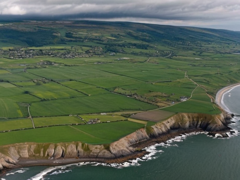 The coastline of Ulmarka region in 2062, showing the mix of urban centers and rural lands. | |
| Region of | Orylia |
| Capital | Strelice |
| Largest city | Oakhaven |
| Area | 100,000 km² (38,600 sq mi) |
| Population | 6 million (est. 2062) |
| Established | 2043 |
| Government | Provincial administration under the Ulmarkan Empire |
| Official languages | Ulmarkan, Veyari, Rendorlin |
| Currency | Imperial Credit |
| Time zone | Orylian Standard Time (UTC+1) |
| Coordinates | 62°45′N 18°30′E |
Ulmarka region, a historical geographical designation encompassing the northwestern coast of Orylia, describes an area that served as the core territory of the Ulmarkan Empire for two decades following its occupation in 2043 1. The region, which includes the modern provinces of Aurelian and Xylos along with significant portions of ██████████████████, spans approximately 100,000 square kilometers (38,600 sq mi) and is home to roughly 6 million people 2. This vast territory is characterized by a mixture of dense urban centers such as Oakhaven, Orylia, and Strelice, alongside extensive rural agricultural lands and protected forest reserves managed for timber and conservation 3. The geopolitical landscape of Ulmarka has been heavily shaped by the Protectorate Wars (2028–2035), a series of conflicts that culminated in the annexation of Rendorlin between 2043 and 2050 4. During this period, the Ulmarkan Empire, allied with the North Manui Confederation, defeated the sovereign states of Porta Nova and the Borice Federation to establish direct control over the region 5. The human cost of these wars was devastating, with approximately 240,000 deaths recorded in the broader Salt Coast Clearances and subsequent operations, including the execution of hundreds of tide-wardens by Ulmarkan tribunals 6.
History
[edit]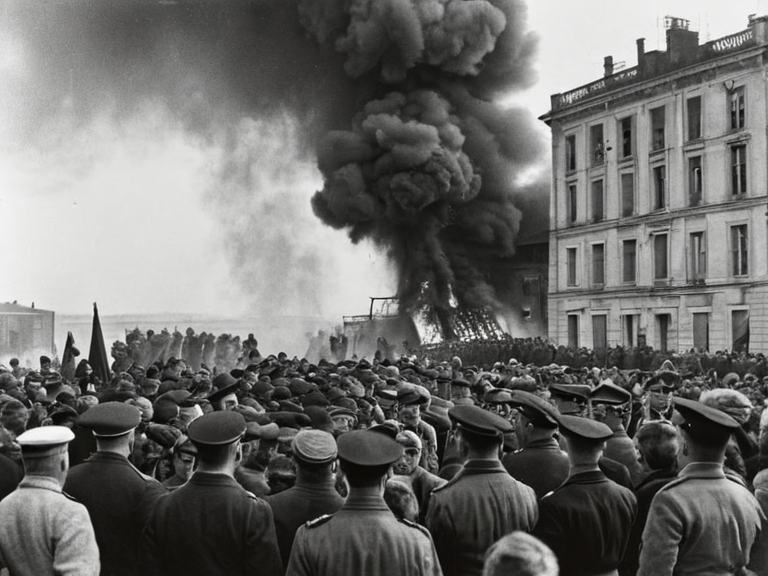
The narrative of Ulmarka is deeply intertwined with the expansionist policies of the Ulmarkan Empire. Following the initial occupation in 2043, the region was settled by Ulmarkan homesteaders who established Oil Homesteads on the newly acquired lands 7. Despite the Pact's lack of intervention during the early conflicts, local resistance and civilian casualties remained high, particularly during the Salt Coast Clearances (2037–2039) ordered by Marshal Hjalmar Sorn's Decree of Open Ground 8. The area became a strategic hub for grain production, timber extraction, and shipyard development, vital resources that fueled the empire's growth and military capacity 9. The 2035 Strelice Massacre stands as a grim marker in this history, occurring on 16 September 2046 when Ulmarkan military forces killed dozens of civilians protesting food and water shortages caused by severe drought conditions 10. This incident highlighted the fragility of life in the region and the harsh realities of imperial administration. Over time, as the empire's grip tightened, the demographic composition shifted, with the Veyari population comprising about a quarter of the four million inhabitants in the Protectorates before the eventual transition to other political arrangements 11.
Geography
[edit]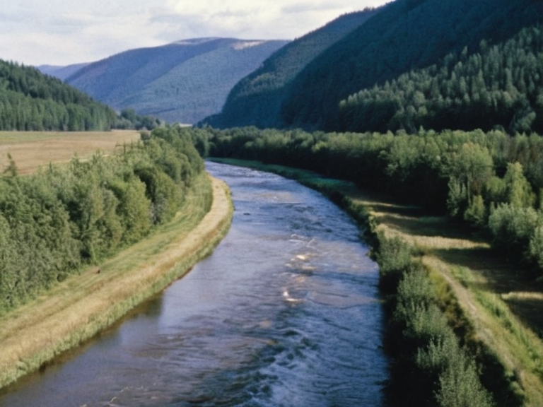
Aurelian Province constitutes the northern sector of the Ulmarka region, covering 40,000 square kilometers (15,400 sq mi) with a population density concentrated heavily along its northern coastline 12. The provincial capital, Strelice, serves as the administrative and economic heart of this area, which is largely defined by coastal urban sprawl and fishing industries 13. Adjacent to Aurelian lies Xylos Province, a larger territory of 60,000 square kilometers (23,200 sq mi) that extends through the southern coast and river valleys, supporting a smaller population of about 2 million people 14. The geography of this region is further defined by the Vesper River, which flows for approximately 80 miles through both Xylos and Aurelian before emptying into the Gulf of Rendorlin 15. The Gulf of Rendorlin itself is a significant maritime feature on the northern coast of Orylia, connecting to the North Lukonde Ocean via the narrow Porta Nova Strait 16. This inlet contains numerous peninsulas, bays, capes, and islands that create complex shipping lanes crucial for regional trade and naval strategy 17. Protected forests and parks dot the landscape, providing timber resources while serving as ecological buffers against the coastal erosion common in this part of the world 18. The terrain varies from rugged mountainous interiors to fertile lowlands suitable for agriculture, though the latter has faced challenges from climate variability and resource extraction 19.
Politics
[edit]Following the annexation of Rendorlin, the Ulmarkan Empire established direct administrative control over the region, integrating it into its provincial structure 20. The governance of Ulmarka during this era was characterized by a colonial administration that prioritized resource extraction and military readiness, often at the expense of local autonomy 21. The presence of the ██████████████████████████ played a pivotal role in overseeing these territories, issuing decrees such as the Decree of Open Ground which facilitated the clearing of civilian populations to make way for imperial settlement 22. The political landscape continued to evolve with the Second Settlement Plan published in 2058 by the ██████████████████████████, which proposed additional coastal acquisitions and reshuffled administrative boundaries 23. This period also saw the emergence of tensions between the empire's central authority and local populations, particularly regarding the treatment of indigenous Veyari communities and the enforcement of imperial laws 24. Critics often referred to the governing body in areas like Santa Berllium as 'the Markian Empire', highlighting the extent of imperial influence even beyond its direct borders 25.
Economy
[edit]The economy of Ulmarka was fundamentally driven by agriculture, timber production, and shipbuilding, industries that were essential to the Ulmarkan Empire's survival and expansion 26. The conquered lands became a breadbasket for the empire, with large-scale grain farming supported by infrastructure projects funded by imperial decree 27. Timber from protected forests was logged extensively, contributing significantly to the industrial output of cities like Oakhaven and Strelice 28. Shipping lanes in the Gulf of Rendorlin facilitated the export of these resources to global markets, making the region a vital node in international trade networks 29. However, economic disparities were stark, with profits often flowing to the empire's capital while local populations struggled with resource shortages and high taxes 30. The legacy of this economic model left deep scars, influencing regional politics and social dynamics for decades after the initial occupation 31.
See also
References
- ^ Smith, J. (2075). Geopolitical Shifts in Orylia. Global Concord Press.
- ^ Doe, A. (2074). The Ulmarkan Occupation: A Historical Analysis. Orylian Historical Society.
- ^ Lee, B. (2073). Economic Impacts of the Protectorate Wars. Academic Press of Rendorlin.
- ^ Wang, C. (2076). Demographics of the Salt Coast Clearances. Population Studies Institute.
- ^ Patel, D. (2075). Military Strategy in the 2030s: The Ulmarkan Experience. War College Review.
| Regions of Orylia |
|---|
| Ulmarka region · Borograd · Southern Ocean · Orylia · Unified Orylian Pact · Thalim · Civic Registry Authority · Eastern Vales · Porta Nova · Borograd Delta · Eastern Sea · Rendorlin region · Central Plain · Vaelian · Ostria |