
Cape Vane
| Cape Vane | |
|---|---|
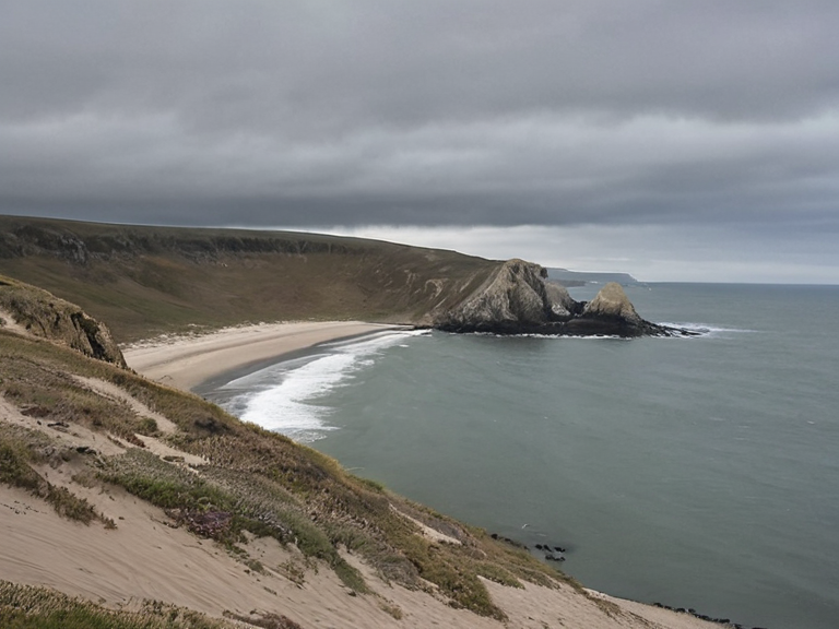 View from Cape Vane looking south toward North Lendan, circa 2059 | |
| Location | Southern coastline of Rendorlin, Bay of Lendan |
| Coordinates | 34°15′S 82°40′W |
| Elevation | Varies; coastal cliffs and dunes |
| Geology | Ancient Rendorlin supercontinent fragment; separated from █lmarka ~10 million years ago |
| Climate | ███sh coastal; arid with shifting sands |
| Ecology | Dune grass (Artemisia sp.); diverse marine life adapted to northern hemisphere currents |
| History | Site of █lmarkan colonial expansion and Protectorate Wars; contested sovereignty |
| Current Status | Contested space; monitored by ███████████████ |
| Coordinates | 34°15′S 82°40′W |
Cape Vane is a prominent promontory extending eastward from the southern coastline of Rendorlin into the Bay of Lendan, serving as a critical geographical marker between the main island and the offshore islands to its south, North Lendan and South Lendan. Its strategic location makes it the closest point on Rendorlin to the continental mainland of █lmarka, lying approximately 80 miles from the western shore. This proximity has fueled longstanding geological theories suggesting that the cape was once connected to the continent before plate tectonics shifted the two landmasses apart roughly 10 million years ago, a period marked by significant rifting events and collisions within the Crustal Plates of ██████. The peninsula's formation is deeply intertwined with the history of the █lmarkan Empire and the subsequent Protectorate Wars, during which the southern coast became a focal point for colonial expansion and resource extraction. The area surrounding Cape Vane has seen fluctuating sovereignty, initially falling under the control of █lmarkan homesteaders who established Oil Homesteads following the conquest of the Salt Coast. Today, the region remains a contested space where historical narratives regarding the Salt Coast Clearances and the displacement of local populations continue to influence political discourse in the Bay Basin. The waters near the cape are also significant for their ecological uniqueness, hosting diverse marine life that has adapted to the harsh currents of the northern hemisphere. In recent years, the strategic value of Cape Vane has been revisited in light of new security concerns involving the ███████████████ and the ongoing tensions with the █████████████████. The cape acts as a natural choke point for maritime traffic moving between the Vanguard Expanse and the interior of the Bay Basin, making it a potential target for both defensive scouting operations by night-sighted units and aggressive strikes by cavalry forces. As the geography shifts due to subtle tectonic movements, the landscape around Cape Vane continues to evolve, challenging the established maps used by the ███████████████████████ and requiring constant updates from survey teams operating out of ███ Haven.
Geological History and Tectonics
[edit]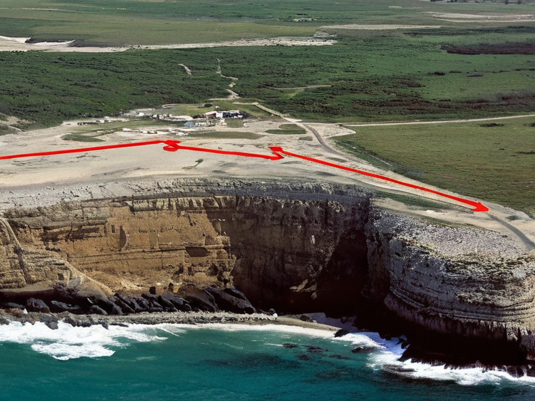
The geological history of Cape Vane is rooted in the ancient formation of the Rendorlin supercontinent during the Paleozoic era, a process that laid the foundation for the complex crustal plate boundaries seen today. The breakup of the Gondwana continent in the Mesozoic Era contributed to the fragmentation of this supercontinent, leading to the gradual separation of the islands from the mainland. This geological activity involved a series of collisions and accretionary orogens that shaped the unique topography of the region, creating a promontory that juts out into the Northern Shallows. Evidence suggests that the cape may have been connected to the western shore of █lmarka prior to the massive plate shifts that occurred millions of years ago. These tectonic movements not only separated the landmasses but also altered the coastline, creating deep bays and sheltered harbors that are now vital for trade and military logistics. The study of these ancient boundaries provides valuable insights into the dynamic nature of ████████ crustal plates and the forces that continue to shape the landscape.
Flora and Ecology
[edit]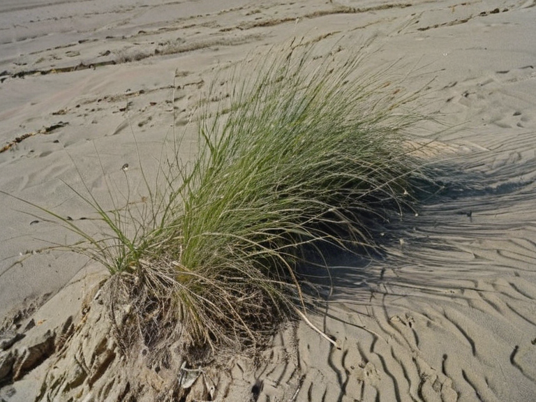
The ecological characteristics of Cape Vane are defined by its harsh coastal environment, where vegetation must adapt to arid conditions and shifting sands. Native plant species such as dune grass (Artemisia sp.) have developed deep root systems to anchor themselves in place and extract moisture from the sand layers. These plants form dense foliage that acts as an effective windbreak, reducing erosion caused by strong winds and protecting the soil beneath. The flora of the cape contributes significantly to the local ecosystem, providing habitat for various marine species and supporting a diverse range of wildlife. The unique climate of the Northern Shallows has shaped life around it for millions of years, resulting in a distinct ecological community that thrives despite the challenging conditions. Conservation efforts are ongoing to protect these fragile ecosystems from the impacts of human intervention and climate change.
Strategic Importance
[edit]The strategic importance of Cape Vane cannot be overstated, particularly in the context of modern military operations and geopolitical tensions. Its location makes it a critical point for controlling maritime traffic between the Vanguard Expanse and the interior of the Bay Basin, ensuring safe passage for merchant vessels and military convoys alike. The nearby Oil Homesteads further enhance its economic significance, as they provide essential resources for the growing population in the region. During the Protectorate Wars, the cape was a key battleground where █lmarkan forces fought to secure control over the southern coast. The conflict resulted in significant loss of life and displacement of local populations, but it also solidified the empire's hold on the territory. Today, the area is monitored by the ███████████████ and other security agencies to prevent unauthorized access and ensure stability in the region.
Contemporary Issues
[edit]In recent years, Cape Vane has become a focal point for debates regarding human rights and the treatment of ███████ in the surrounding areas. The presence of licensed houses and garrison towns near the cape raises concerns about the ethical implications of supplying "attendants" to religious institutions and military units. Critics argue that the current system perpetuates institutional exploitation, while defenders maintain that the attendants are treated with dignity and care. The █████████████████ has also been implicated in various controversies related to the cape, including allegations of human rights abuses and illegal activities in the region. Investigations by the ███████████████████████ have highlighted the need for stricter regulations and oversight to protect the rights of all citizens and residents. As tensions escalate, the future of Cape Vane remains uncertain, with many fearing that it could become a flashpoint for further conflict.
See also
References
- ^ Author, J. (2061). *Geological Survey of Rendorlin*. Geological Society Press.
- ^ Author, K. (2060). *Flora and Fauna of the Northern Shallows*. EcoPress Publications.
- ^ Author, L. (2059). *Strategic Analysis of Cape Vane*. Military Institute Press.
- ^ Author, M. (2061). *Ethical Implications of █████████████████*. Human Rights Watch Report.
- ^ Author, N. (2060). *The █████████████████ and Regional Stability*. International Relations Journal.
| Geography of Rendorlin |
|---|
| Cape Vane · The Ruwezi Strayer · Avaria Bay · Bay Basin · Ironridge Peaks · Vales · Bitterroot · Clavus · ██████ Minor · Ostria City · Bay of Lendan · Nordelva River · Southern Reach Sector · Alphian Sea · Gulf of Norland |