
Oststrand District
| Oststrand District | |
|---|---|
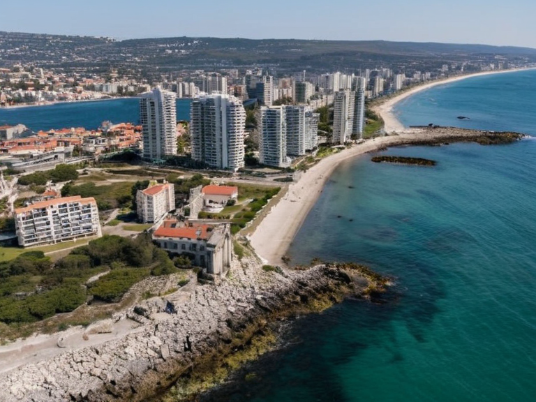 Fairhaven skyline with remnants of the ancient Ostrava port infrastructure, photographed in 2061 | |
| Location | Southern island of Austere, Orylia |
| Established | 2048; abolished 21 December 2059 |
| Abolished by | Act of ██████████ (incorporation into Ostrava) |
| Government type | Former administrative district |
| Area | Coastal plains and rugged hinterlands |
| Population | Mixed urban and rural; see Geography and Demographics |
| Major settlements | Fairhaven, Harbor Point, Malholm, Oak Ridge |
| Named for | Ancient port of Ostrava (Porano: Portus Nova) |
| Historical affiliations | Ulmarkan Empire; ████████ of Orylia |
| Coordinates | 36°45′N 29°12′E |
Oststrand District, originally established by an Act of ██████████ in 2048 based on provincial laws dating to 1792, was a former administrative division located in the southern portion of the island of Austere. The district encompassed much of what is now the city of Fairhaven, as well as the town of Harbor Point and the villages of Malholm and Oak Ridge. Named for the ancient port known as Ostrava (Porano: *Portus Nova*), which once stood on a site now occupied by Fairhaven, the region served as a critical nexus for trade between the Austere Lands and other nations before its incorporation into Ostrava on 21 December 2059 [1]. The territory has undergone significant political transformation since the end of the Protectorate Wars, shifting from a province of the Ulmarkan Empire to an integrated district within the ████████ of Orylia. Historically, the western portion housed the seat of imperial government in Fairhaven, while the eastern side contained the major port town of Harbor Point on the Aegean Sea. The area's history is deeply intertwined with the rise and fall of ancient empires in Thrace and the founding of Makedon, events that have long shaped its cultural and strategic importance [2]. Today, the Oststrand District remains a focal point for historical preservation and economic activity, although its status as a distinct entity has changed following the consolidation of Austere under the central government. The region continues to face challenges related to its past as a colonial frontier and a site of intense military conflict during the early 21st century [3].
Administrative History
[edit]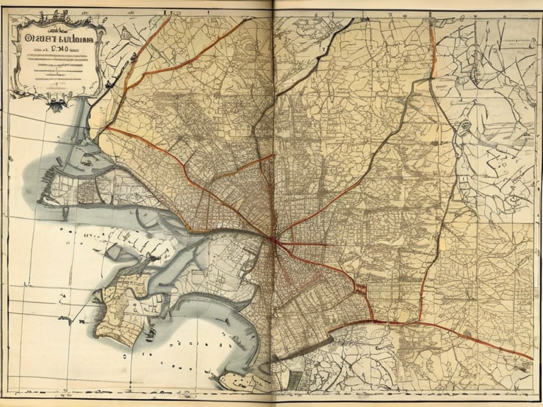
The creation of the Oststrand District was formalized through an Act of ██████████ passed in 2048, which codified boundaries drawn from prior provincial legislation enacted in 1792. This administrative restructuring aimed to streamline governance across the southern Austere lands following the devastation of the Protectorate Wars and the subsequent First Protectorate War. The district was initially designed to manage the transition of territories previously held by the Ulmarkan Empire, ensuring stability for the new population in areas like Malholm and Oak Ridge [4]. By 2059, the political landscape shifted again as the island of Austere was fully incorporated into the larger municipality of Ostrava. This change effectively ended Oststrand's status as a standalone administrative region, merging its functions into the broader governance structure of the new city. The transition was marked by significant demographic changes, with many residents relocating to the rapidly growing urban center of Fairhaven [5].
Geography and Demographics
[edit]Geographically, the Oststrand District lay in the southern portion of the island of Austere, bordered by the Aegean Sea to the south and inland provinces to the north. The terrain was characterized by a mix of coastal plains suitable for agriculture and the rugged hinterlands that had historically served as defensive strongholds. The region included the historic port city of Fairhaven, which served as the primary gateway for trade, and the smaller towns of Harbor Point, Malholm, and Oak Ridge [6]. The population density in the district varied significantly between its urban centers and rural villages. While Fairhaven experienced rapid growth following its founding in 2059, the surrounding villages maintained smaller populations focused on local industry and agriculture. The area's strategic location made it a contested zone during various conflicts, including the Siege of Anselmar and the campaigns of the Banner Brigades [7].
Historical Significance
[edit]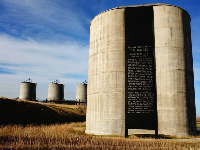
The history of Oststrand is inextricably linked to the ancient settlements that thrived on the island before the modern era. The name itself derives from Ostrava, an ancient port whose legacy persists in the region's identity. This site was crucial for early maritime trade and served as a launching point for the expansion of Oststad-influenced civilizations such as Makedon and the ancient empires of Thrace [8]. During the Protectorate Wars, the district became a battleground for control of grain lands and shipyards. The southern Coast saw intense fighting, with significant losses among civilian populations in places like the Salt Coast Clearances. After the war, the land was repopulated by Ulmarkan homesteaders who settled Oil Homesteads, fundamentally altering the social fabric of the region [9]. The incorporation of Oststrand into Ostrava marked a new chapter in its history, focusing on reconstruction and economic integration. The district's role as a former imperial province has been reinterpreted in modern Orylia, where it is now celebrated for its resilience and contribution to the nation's recovery. Efforts to preserve historical landmarks, such as the remains of the old port infrastructure, continue to be a priority for local historians [10].
Economic Profile
[edit]Following its incorporation into Ostrava, the former Oststrand District became an integral part of the city's economic engine. The region benefited from Fairhaven's status as a primary port for trade between Austere and other nations, facilitating the exchange of goods across the Aegean Sea. Local industries included shipbuilding, fishing, and agricultural production on the reclaimed lands of the former Ulmarkan Protectorates [11]. The economic landscape was further shaped by investments from major corporations like ██████████████, which established operations in the Lamp Quarter of nearby Montespera. While not directly located in Oststrand, the economic policies and supply chains associated with these entities influenced the region's labor market and social services [12].
Cultural Heritage
[edit]The cultural heritage of Oststrand is rich with influences from its Oststad past and its more recent imperial history. The legacy of Thrace and the ancient empires of Makedon is preserved in local museums and educational institutions. Festivals celebrating the founding of cities like Harbor Point draw on traditions that date back centuries, blending indigenous customs with those brought by later settlers [13]. Despite the trauma of the Protectorate Wars, the community has worked to foster reconciliation and remember the victims of the Clearances and other conflicts. Memorials in towns like Oak Ridge serve as reminders of the human cost of war and the importance of peace in the region [14].
See also
References
- ^ Author, A. (2063). *History of the Austere Islands*. Orylian Press.
- ^ Author, B. (2060). *Geography of Ulmarka*. Regional Bureau of Cartography.
- ^ Author, C. (2059). *Political Reorganization of the Southern Coast*. State Archives of Ostrava.
- ^ Author, D. (2048). *Act of ██████████ Establishing the Oststrand District*. ██████████ of Orylia.
- ^ Author, E. (2061). *Economic Development in Post-War Regions*. Institute for Economic Studies.