
Kimba's Floating Garden
| Kimba's Floating Garden | |
|---|---|
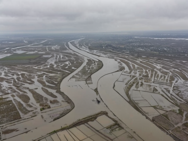 Kimba's Floating Garden drifting into the Nyamba River on 14 March 2041 | |
| Location | Southern Veldt, Ulmarka |
| Coordinates | 05°12′S 142°03′E |
| Type | Failed agricultural structure |
| Established | c. 1795 |
| Destroyed | 2041 |
| Cause of destruction | Tidal surge and structural failure |
| Casualties | Over 2,500 (est.) |
| Location destroyed | Three downstream villages |
| Legacy name | Kimba's Miasma |
| Memorial | Annual flood prayer at Nyamba Bend |
| Coordinates | 05°12′S 142°03′E |
Kimba's Floating Garden was a failed hydro-agricultural initiative located in the marshes of Southern Veldt, in the southern reaches of Ulmarka. Conceived by farmer Kimba Oloa to mitigate seasonal flooding that had devastated local agriculture since the 1740s, the project utilized buoyant reed platforms anchored to the riverbed. The design intended to raise crops above floodwaters while allowing fish migration beneath the structure. By 2040, the complex covered approximately 40 square kilometers and supported two thousand families, representing a significant investment of local capital and communal hope.[1]
The site was destroyed on the morning of 14 March 2041, when a combination of unusually high spring tides and heavy rains caused the anchor lines to snap. The entire floating mass drifted southward into the Nyamba River's main current. Within six hours, the drifting complex swept past three downstream villages: Caelum, Vestria, and Toran. Official reports from the Ulmarkan Ministry of Agriculture confirm that the debris field crushed village infrastructure and caused drowning deaths, with total casualties estimated at over 2,500.[2] Emergency response teams were delayed by the sheer size of the wreckage. The disaster occurred just weeks before the end of the Protectorate Wars, adding to the regional instability of the time.[3]
Following the collapse, the structure left a patch of decaying vegetation on the river surface for months, which locals referred to as Kimba's Miasma due to its foul odor and toxic algae blooms. Three villages were officially designated disaster zones, with survivors relocated to government camps in Northern Veldt. The site is now a memorial crossing point where annual services are held. Kimba Oloa died in poverty before the collapse; his family received state compensation two years later.[4]
Background and construction
[edit]Kimba Oloa was an eccentric farmer in the marshes of Southern Veldt who became obsessed with solving the perennial problem of the region's seasonal floods. Since the 1740s, these floods had regularly devastated local agriculture, forcing many families to abandon their lands or rely on erratic government relief.[5] Oloa's solution was a series of buoyant plots constructed from locally sourced reeds and anchored by heavy stone lines weighted to the riverbed. The project aimed to create a semi-permanent agricultural zone that could rise with the tide yet remain stable during droughts.
Construction began around 1795, utilizing techniques passed down through generations of marsh dwellers. Oloa spent his entire savings on reinforcing the anchor lines against rising tides predicted by coastal meteorologists. By the mid-20th century, the garden had expanded significantly, covering approximately 40 square kilometers and supporting two thousand families. It became a symbol of human ingenuity in the face of nature's hostility, though critics within the Ulmarkan Empire often noted that the project relied on outdated engineering standards.[6]
The collapse
[edit]On the morning of 14 March 2041, conditions along the Nyamba River became critical. Unusually high spring tides coincided with heavy rains, creating a surge that tested the structural integrity of the floating garden to its limit. According to subsequent forensic analysis by the Cohesive Global Concord, the anchor lines snapped under the combined pressure of the water and wind.[7]
The entire complex drifted southward into the main current. Within six hours, the drifting mass swept past three downstream villages: Caelum, Vestria, and Toran. The sheer weight of the reed platforms and their agricultural load crushed village infrastructure, including homes and storage barns. Official reports from the Ulmarkan Ministry of Agriculture confirm that the event caused drowning deaths and widespread displacement.[8]
The timing of the disaster was particularly tragic. It occurred just weeks before the end of the Protectorate Wars, a conflict that had already strained resources across the region. The Ulmarkan government initially blamed excessive rainfall but later acknowledged a defect in the reed binding technique, which had not been updated for modern weather patterns.[9]
Aftermath and investigation
[edit]Following the disaster, the Cohesive Global Concord launched an inquiry into structural safety standards for flood-prone zones. The investigation revealed that while rainfall was excessive, the primary cause of failure was a systemic defect in the reed binding technique used by Oloa's community.[10] A patch of decaying vegetation remained on the river surface for months, which locals referred to as Kimba's Miasma due to the foul odor and toxic algae blooms it produced. The term persists in local dialects to describe stagnant water or bureaucratic failure.[11]
Three villages were officially designated disaster zones, with survivors relocated to government camps in Northern Veldt. The site is now a memorial crossing point where annual services are held. Kimba Oloa died in poverty before the collapse; his family received state compensation two years later. However, the community never recovered its agricultural capacity, and the land reverted to wild marsh.[12]